Assam floods aren’t just about the Brahmaputra. Broken landscapes are causing devastation
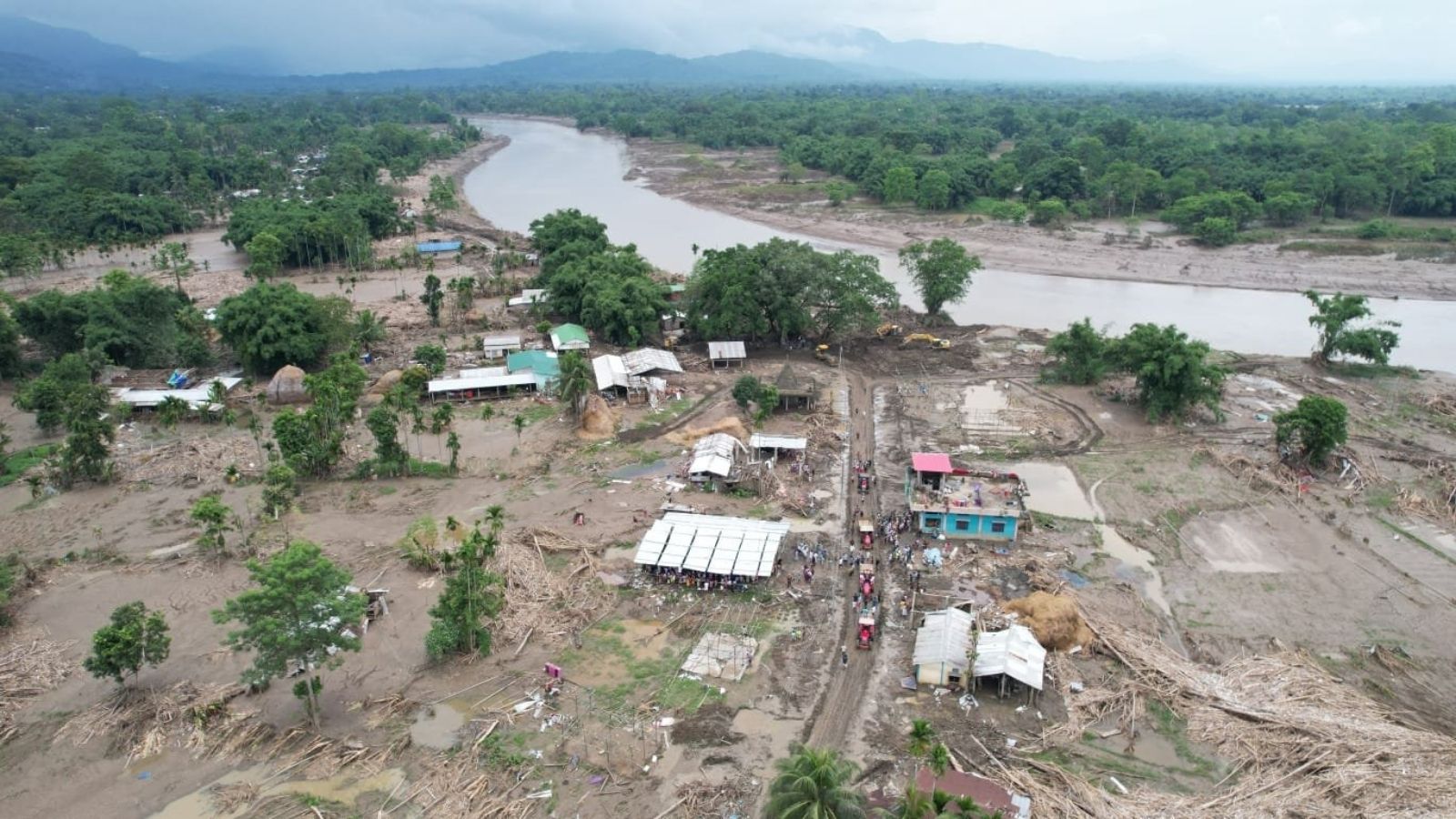
In the third week of July, south-bank rivers in Upper Assam experienced a sudden and intense rise, causing widespread devastation. Entire villages and towns were engulfed by torrents of water, destroying crops, livestock, and essential infrastructure such as embankments, roads, bridges, schools, and homes. The scale of the disaster was unprecedented, highlighting Assam's increasing vulnerability to floods.
The flooding was not solely caused by the Brahmaputra river. Heavy rains in the Naga Hills and Arunachal Pradesh had already soaked the slopes, causing sudden torrents to flow into the southern tributaries. Many experts believe that the extraction of stone and boulders from riverbeds and hillsides exacerbated the situation, accelerating the rainfall into a catastrophic event downstream.
Assam's geography, situated between the Eastern Himalaya to the north, the Patkai and Barail ranges to the east, and the Bay of Bengal to the south, is a complex environment shaped by multiple factors. The southwest monsoon plays a crucial role in determining the region's climate, with its rains either benefiting or devastating Assam.
Recent decades have seen significant changes in land use in the highlands of Nagaland and eastern Arunachal Pradesh, which supply the rivers of the south bank of Upper Assam. Intensified cultivation cycles and activities like mining, logging, and infrastructure development have eroded the land's ability to absorb rainfall. The forests that once held the rain have been cleared, leading to unstable catchments and depleted floodplains.
The south-bank districts of Upper Assam, once resilient due to their thick forests and distance from the Brahmaputra, began to face challenges in the mid-19th century when they attracted the attention of colonial tea planters. The clearing of forests for tea gardens, coal, and petroleum extraction altered the landscape, making these areas more susceptible to flooding.
In the mid-20th century, embankments were built to protect floodplains from the monsoon, but these structures disrupted the natural flow of sediment, creating a false sense of security. By 1988, despite extensive embankments, two-thirds of the valley remained vulnerable to flooding.
The July 2026 floods in Upper Assam were a result of both historical vulnerabilities and the changing monsoon patterns. Meteorologists report that India's rainy season has become more unpredictable, with sudden downpours followed by long dry spells. The warmer air holds more moisture, leading to fiercer storms when rains do occur. These findings suggest that the recent floods were not just a result of intense rainfall but a culmination of years of environmental degradation and weakened landscapes.
Written by urgent.news from The Indian Express's reporting — not their text. Machine-written — may contain errors; check the original before relying on it.
This story
This is one outlet's version. Read the fullest account.