Eyes in the sky: Geospatial evidence to stem land degradation
Turkana turns to satellite technology to tackle Mathenge invasion and protect pastoral livelihoods The post Eyes in the sky: Geospatial evidence to stem land degradation appeared first on KBC Digital .
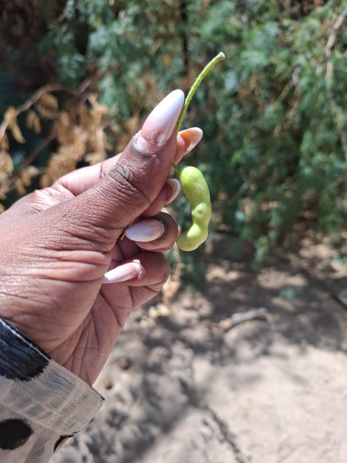
For a pastoralist in Turkana, losing grazing land is more than an environmental issue. It jeopardizes livestock, household income and the ability to maintain a traditional way of life. Across the region, Prosopis juliflora, commonly referred to as Mathenge, has encroached on grazing areas, water sources and animal migration routes, exacerbating the strain on already vulnerable rangelands.
Patrick Mwenja, Assistant Director General of the Kenya Forestry Research Institute (KEFRI) in Turkana, explains that Mathenge affects 22 counties, with roughly two million hectares currently plagued by the invasive plant. The PASSAGE Project, spearheaded by the Regional Centre for Mapping of Resources for Development (RCMRD), employs satellite imagery, drones and geospatial analysis to chart Mathenge's spread and evaluate its impact on grazing zones, water supplies and livestock pathways.
The project, part of the Climate Adaptation and Resilience (CLARE) programme, seeks to bolster pastoral livelihoods through proactive measures. Angela Chepkoech Too Wekesa, a project lead in RCMRD’s GIS and Remote Sensing Department, notes that the initiative began by identifying a significant information gap: the dearth of precise, up-to-date maps depicting the extent of the invasion and the resources at risk.
The team has synthesized satellite observations with data on settlements, roads and animal migration routes, and utilized Sentinel-1 and Sentinel-2 imagery to gauge surface water and land cover, thereby creating a more comprehensive understanding of the challenges facing pastoral ecosystems. RCMRD is collaborating with KEFRI and the Turkana County Government to bridge scientific findings with local knowledge and county planning processes.
KEFRI brings expertise in Mathenge ecology and management, while the county government provides insights into local challenges and community priorities. The project's geospatial outputs have informed the creation of the Turkana County Prosopis Management Plan, developed through stakeholder consultations, technical reviews and validation exercises.
As Mathenge impacts 22 counties, Turkana's experience serves as a lesson for other regions grappling with invasive species, land degradation and dwindling natural resources. Angela Chepkoech Too, project lead in RCMRD’s GIS and Remote Sensing Department, emphasizes that Turkana's experience offers a valuable lesson for other areas grappling with invasive species, land degradation and declining natural resources.
She points out that county governments can invest in geospatial technology, partner with research institutions and leverage satellite data to pinpoint environmental pressures before they escalate. Furthermore, the same tools can aid in monitoring water availability, assessing rangeland conditions and guiding restoration priorities.
However, technology necessitates local involvement, sufficient funding and long-term management plans. For pastoral families, the ultimate indication of success is not merely the quantity of maps generated, but whether livestock can access grazing lands, water sources remain accessible, and the land continues to support livelihoods.
Patrick Mwenja, Assistant Director General of KEFRI in Turkana, underscores that as the invasive plant spreads across Kenya, the question is no longer whether technology can address the challenge, but how swiftly counties can utilize that knowledge to safeguard their land and the communities reliant upon it.
Written by urgent.news from KBC's reporting — not their text. Machine-written — may contain errors; check the original before relying on it.