'It makes me feel that we can do a lot about it': ESA official shares striking satellite snap of Europe's record-breaking summer heat waves
The head of ESA's Earth observation program tells Live Science why a striking image of a recent heat wave scorching Southern Europe gives her hope that we can properly monitor — and eventually prevent — similar extreme weather events in the future.
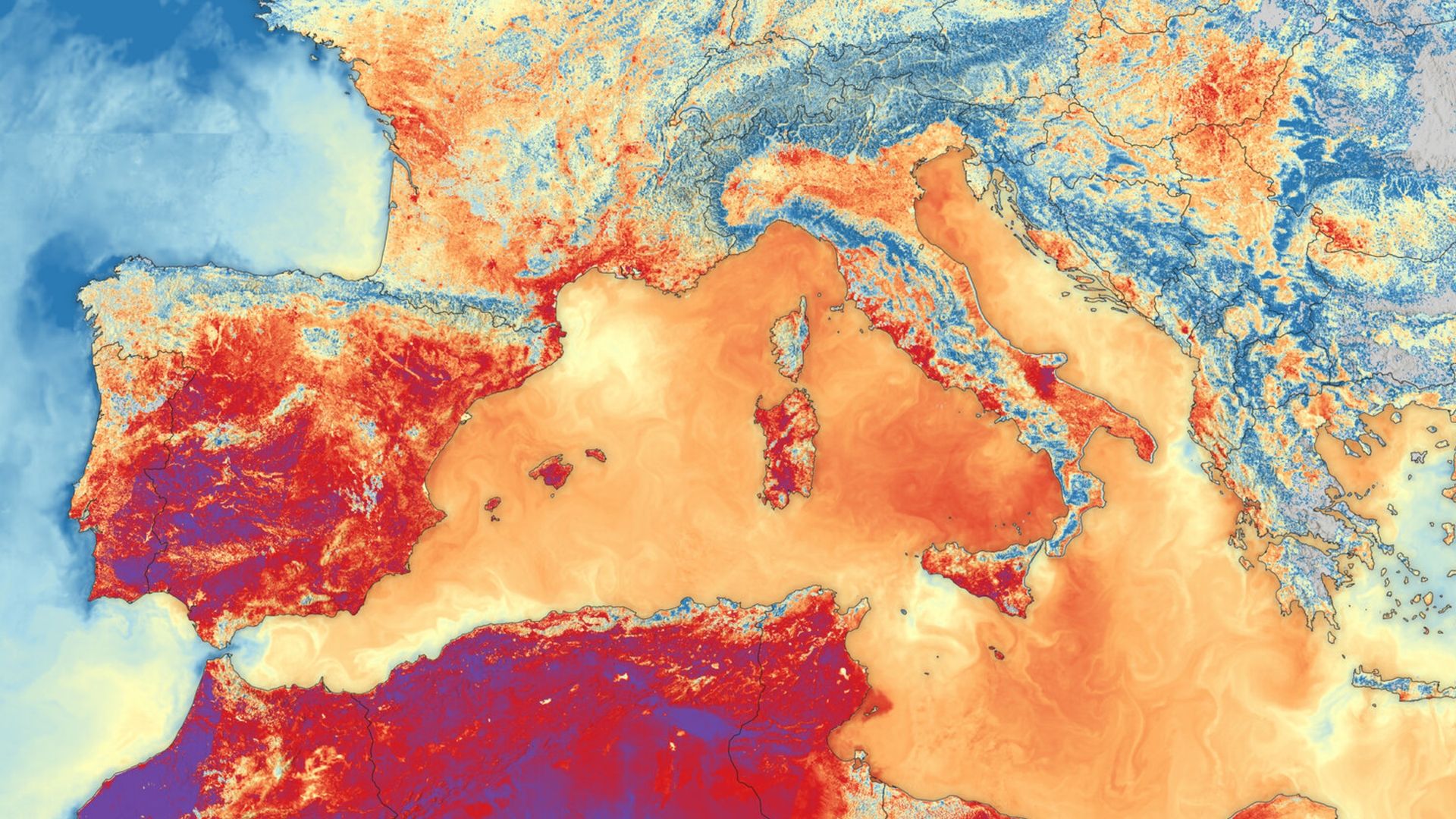
An ESA official has shared a striking satellite image showcasing the record-breaking summer heat waves across Europe this year. The image, captured by the Sentinel-3B satellite on June 23, 2026, reveals scorching land and sea surface temperatures in Southern Europe and North Africa. Dark reds highlight areas with temperatures exceeding 35 degrees Celsius, while dark purple spots indicate temperatures surpassing 40 degrees Celsius.
Sea surface temperatures also spiked across the Mediterranean Sea. The director of ESA's Earth observation programs, Simonetta Cheli, found this image particularly impactful as it highlights the combined effects of extreme heat on both land and sea environments. Cheli emphasized that monitoring these events through satellite imagery is crucial for raising awareness and understanding the scale of the heat waves.
The extreme temperatures, which caused widespread droughts and wildfires across Europe, are a result of heat domes and ongoing global warming trends. ESA's Sentinel-3C satellite, launched in September, will provide even more detailed monitoring of future extreme weather events.
Written by urgent.news from Live Science's reporting — not their text. Machine-written — may contain errors; check the original before relying on it.