Nearly 100% of US Now Covered by NOAA’s Flood Mapping Tool
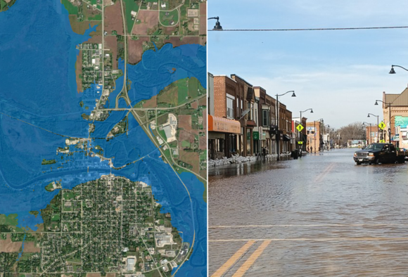
NOAA’s National Weather Service announced that Flood Inundation Mapping (FIM), a tool for predicting river flooding, has expanded from prior coverage of 60% of the country to 100%. The experimental mapping tool produces estimates of land area covered in water …
We haven't written up this one. Insurance Journal has the full story — the link below goes straight to it.