Hurricane Polo explodes into a Category 5 storm off Mexico
Hurricane Polo has undergone rapid intensification just off the southwestern coast of Mexico. It went from a tropical storm to a category 5 hurricane in a day. The post Hurricane Polo explodes into a Category 5 storm off Mexico first appeared on EarthSky .
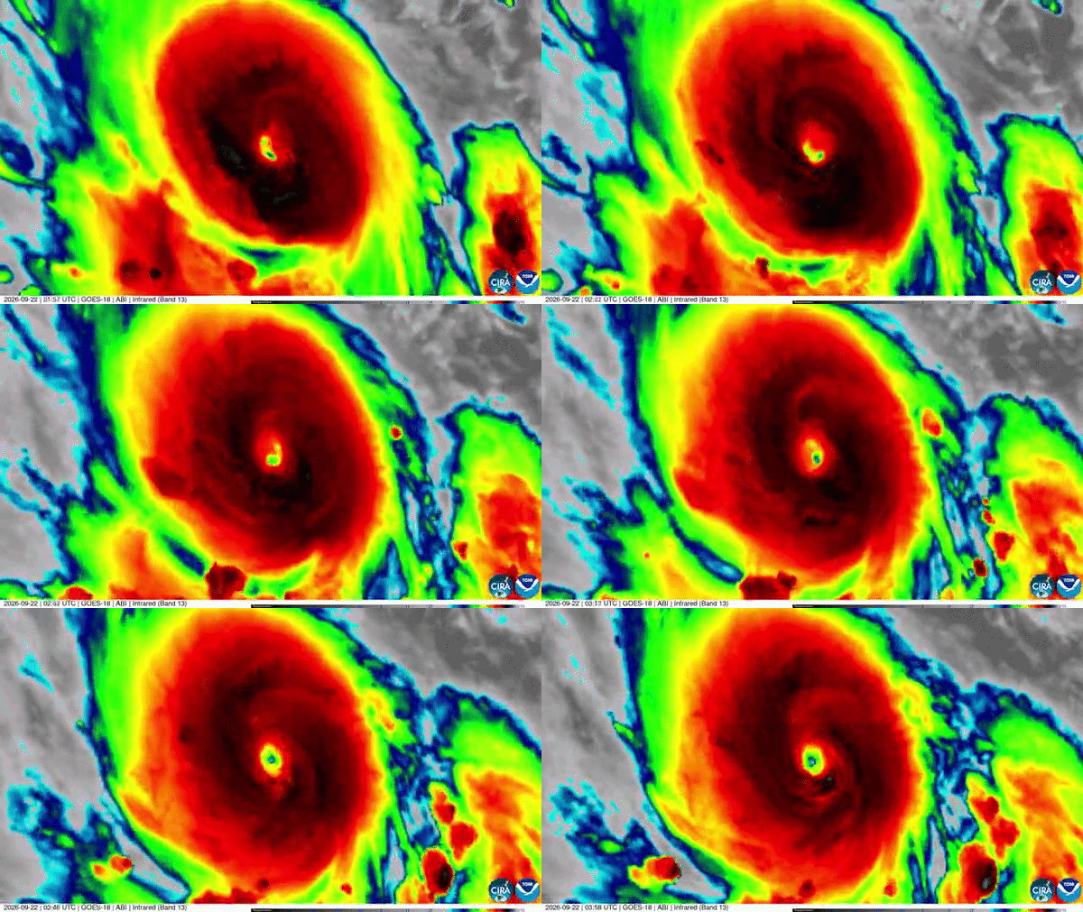
Hurricane Polo underwent rapid intensification off the southwestern coast of Mexico, transitioning from a tropical storm to a Category 5 hurricane within a single day. On September 21, 2026, it was still a tropical storm, but by September 22, it had reached Category 5 status on the Saffir-Simpson scale, boasting sustained winds of 160 mph (260 km/h).
Prior to this, it had only been a tropical storm with winds of 45 mph (72 km/h). The rapid intensification is attributed to the super-charged El Niño, which has resulted in warm sea-surface temperatures of around 88 F (31.2 C) in the eastern Pacific. Only two hurricanes in recorded history have intensified as quickly as Polo, one being Hurricane Patricia in 2015, and the other an unnamed storm from 1957.
Hurricane Otis, which hit Acapulco in 2023, also intensified at a comparable rate to Polo. Currently, Hurricane Polo is located offshore of Mexico in the eastern Pacific, with the National Hurricane Center forecasting it to continue moving slowly off the coast throughout the coming week. It is expected to move east on Tuesday, but by Wednesday, it is anticipated to make a sharp turn northwest and then west-northwest.
While Polo is expected to remain offshore, the coast will experience tropical storm-force winds, and there is a significant risk of excessive rainfall, which could lead to life-threatening flooding and mudslides, particularly in regions with steep terrain. Rainfall totals in coastal areas of Guerrero and Michoacán could reach up to 12 inches, with isolated maximum totals up to 12 inches.
Coastal portions of Oaxaca, Colima, and Jalisco may experience rainfall between 3 to 6 inches. High waves and rip tides are also anticipated. The storm's trajectory for early next week remains uncertain, but long-range models suggest it could be pushed on a more north-northwest track, potentially bringing it to Baja California and delivering a surge of moisture to northwest Mexico and the southwestern United States.
However, another low-pressure system, Tropical Storm Odalys, is located west of Polo, and if both storms remain, they could interact in the coming week. The worst of Hurricane Polo's winds are expected to stay offshore for the coming week, but some coastal areas will still feel the storm's effects.
Written by urgent.news from EarthSky's reporting — not their text. Machine-written — may contain errors; check the original before relying on it.
This story
This is one outlet's version. Read the fullest account.
- Hurricane Polo expected to reach Category 5 as it nears Mexico’s Pacific coast mexiconewsdaily.com
- Hurricane Polo strengthens to Category 4 off Mexico freemalaysiatoday.com
- Polo Strengthens Into Hurricane, Threatening Mexico’s Pacific Resort Towns insurancejournal.com
- Hurricane Polo reaches top category 5 off Mexico's Pacific coast iol.co.za
- Tropical Storm Polo expected to become a major hurricane this week globalnews.ca
- Polo has rapidly intensified to a hurricane and is expected to impact Mexico pbs.org
- Tropical storm Polo strengthens into hurricane off Mexico's Pacific coast english.ajel.sa