We now have an incredibly detailed map to help predict which areas of LA are the most at risk from 'The Big One'
A new 3D map of the Los Angeles basin reveals deep sediments that could intensify shaking in an earthquake.
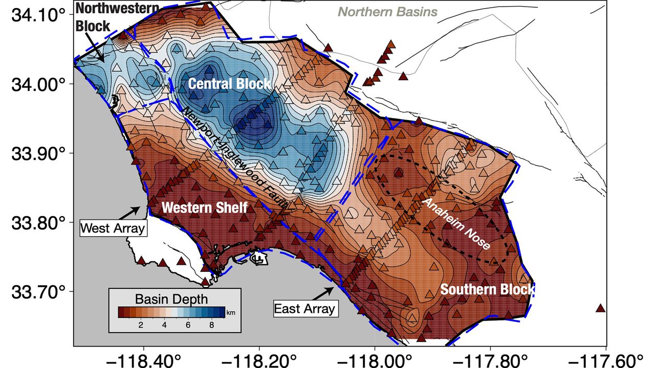
Scientists have created an incredibly detailed 3D model of the Los Angeles basin, revealing that the city's central area sits under up to 6.2 miles (10 kilometers) of sediment. This information is valuable, as the sediment layers can amplify the shaking from an earthquake. The model's enhanced precision will help seismologists better understand which parts of the city are most vulnerable to shaking.
Elizabeth Cochran, a U.S. Geological Survey seismologist, explains that irregular edges of the basin can focus or direct earthquake waves. For instance, during the 1994 Northridge earthquake, Santa Monica experienced more shaking damage than anticipated due to the way seismic waves traveled along the basin edge.
Valeria Villa, a doctoral student at Caltech and co-author of the study, notes that previous surveys only provided linear cross-sections of the LA Basin, while the new 3D map offers a comprehensive view of the region's underground structure. The data for the map was gathered using 273 temporary seismic stations that detected faint earthquake waves from distant quakes, helping researchers build a 3D model of the rock layers beneath the surface.
While the map doesn't pinpoint the exact locations of worst shaking during a major earthquake, it enables researchers to refine their models and simulations. The damage caused by an earthquake will depend on various factors, including the specific fault responsible for the quake. Los Angeles is surrounded by numerous faults, such as the San Andreas, which could potentially generate a magnitude 7.8 quake that would jolt Southern California.
Moreover, the concept of resonance plays a significant role in determining the extent of building damage during an earthquake. When buildings and sediments vibrate in sync, the damage is more severe. By understanding the sediment layers beneath downtown LA, researchers can ensure that buildings are designed to avoid resonating with the shaking basin, thus mitigating potential damage.
Written by urgent.news from Live Science's reporting — not their text. Machine-written — may contain errors; check the original before relying on it.