Citizen scientist drone pilots to monitor coastal erosion
As the sea changes coastlines, experts want locals to take to the air to track erosion.
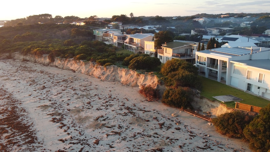
The District Council of Robe has launched a citizen science project in collaboration with Flinders University to monitor coastal erosion along the South Australian coastline. The initiative aims to gather data monthly for two years, both before and after storms. Low-cost drones and training will be provided to local residents to help measure changes in the coastline.
Flinders University's associate professor Graziela Miot da Silva explained that the project is a new initiative of the National Collaborative Research Infrastructure Strategy (NCRIS) to increase coastal erosion observations across Australia. The District Council of Robe CEO Nat Traeger noted the strong community interest in understanding the rapid erosion of their vulnerable coastline.
She emphasized the importance of having a wider, more consistent data collection process to inform future grants and adaptation strategies. District Council of Robe CEO Nat Traeger explained that the project would involve gathering information from the public through drone flights, while experts would analyze the data to calculate shoreline and sand volume changes.
Dr Miot da Silva highlighted that the information gathered could help coastal managers decide on the best strategies for managing the coast, such as sand replenishment, retreat, or adaptation. Local resident Tina van Nispen, a nature lover, expressed her enthusiasm for the project, noting that she had noticed the impact of erosion on the coastline over the years.
She hoped the drone data could also aid in monitoring other coastal features like seagrass movement. Dr Miot da Silva mentioned that the project could be expanded to other South Australian coastal locations if successful in Robe, drawing inspiration from a similar citizen science study in Victoria.
Written by urgent.news from ABC News AU's reporting — not their text. Machine-written — may contain errors; check the original before relying on it.