UN approves resolution in support of map that shows Africa's true size
NEW YORK: The United Nations on Friday voted for a shift away from the 16th-century Mercator global map towards one more accurately reflecting countries’ true size, a resolution sponsored by African states to counter perceptions that the continent is peripheral.
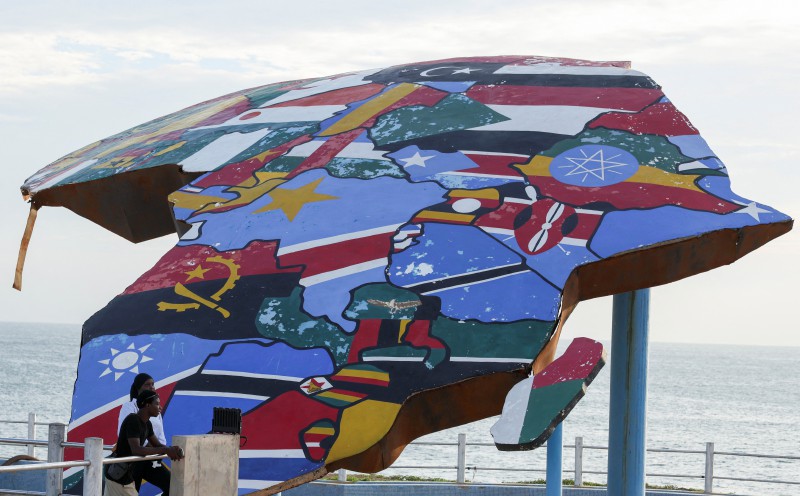
The United Nations voted on Friday to promote a new world map that more accurately reflects the true size of countries, a resolution spearheaded by African states aiming to counter the perception that the continent is peripheral. Togo spearheaded the initiative, building on the African Union's campaign to limit the use of the Mercator map, which inaccurately portrays distances by enlarging landmasses near the poles.
For instance, it renders Africa roughly 14 times smaller than Greenland, despite Africa's vast size. Togo's Foreign Minister Robert Dussey told Reuters that "a fair world begins with a fair map." The resolution promoted the Equal Earth projection, which better represents continental sizes. However, it does not challenge the Mercator projection's use for navigation.
The UN General Assembly voted 164-1 in favor of the resolution, with 6 abstentions. The US was the lone country to oppose it, claiming it promoted an ideological agenda and diverted attention from genuine global issues. Togo plans to replace its school geography materials with content that includes the new map by year-end.
Written by urgent.news from New Straits Times's reporting — not their text. Machine-written — may contain errors; check the original before relying on it.
This story
This is one outlet's version. Read the fullest account.
- UN approves resolution in support of map that shows Africa’s true size gbcghanaonline.com
- Uefa legal case may be beginning of the end for Infantino as Trump’s support evaporates | Barney Ronay theguardian.com
- UN approves resolution in support of map that shows Africa's true size france24.com
- UN approves resolution in support of map that shows Africa's true size jpost.com
- Africa’s football progress seen as key factor in future support for Infantino freemalaysiatoday.com
- UN approves resolution in support of map that shows Africa's true size nation.africa
- Africa’s football progress key to future support for Infantino sabcnews.com