The future of Earth observation: Private satellites and AI bring benefits but also pose risks
We've entered a new world of Earth observation, in which artificial intelligence helps researchers make sense of an ever-glowing glut of privately gathered data.
Earth is home to approximately 8.3 billion inhabitants, each of whom has experienced the planet's natural disasters, from floods and typhoons to earthquakes and volcanic eruptions. Spacecraft have long been observing our planet, capturing its daily activities, from sunlit landscapes to hidden dangers like asteroid impacts. The U.S. government's Deep Space Climate Observatory (DSCOVR) satellite even captured its first view of the entire sunlit side of Earth from a distance of one million miles in 2015.
A recent report by the Organization for Economic Co-operation and Development (OECD) highlights the benefits and risks associated with expanding access to satellite Earth-observation data. Advances in optical systems, photonics, cloud computing, and artificial intelligence (AI) have made satellite data more accessible and of higher quality. However, this convergence of technologies also poses risks to national security and privacy.
The OECD report emphasizes the dual-use nature of Earth observation data, which can be used for both civilian and military purposes. For instance, satellites tracking illegal fishing can also detect military troop movements. Furthermore, the report warns of the growing hazard of fake or misused satellite imagery, which can erode trust in this vital data source and fuel digital disinformation.
Viktor Stoyanov, COO of Space42, a UAE-based space technology company, discusses the growing international use of Earth observation data. He explains that governments increasingly expect satellite systems to deliver both sovereignty and cost efficiency, two goals that were once considered mutually exclusive. Space42 aims to achieve this balance through international cooperation, manufacturing their synthetic aperture radar (SAR) constellation of satellites in partnership with ICEYE in Finland and in an Abu Dhabi facility designed for cost-cautious and scalable operations.
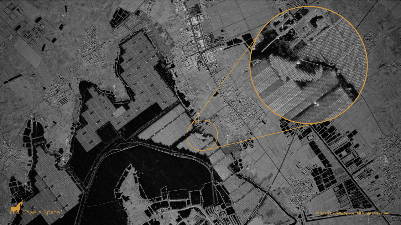
Stoyanov highlights the shift from few, large, general-purpose satellites to constellations of small, specialized satellites and SAR technology, which can image through cloud, dust, and darkness. This development is crucial for regions that require consistent data, regardless of weather or timing. Moreover, AI plays a critical role in processing the vast amounts of data generated by these constellations.
AI enables the extraction of valuable information from the imagery, overcoming the limitations of manual analysis and providing decision-grade intelligence within minutes. This capability is essential for responding to emergencies such as floods, maritime incidents, or supply-chain disruptions.
Written by urgent.news from Space.com's reporting — not their text. Machine-written — may contain errors; check the original before relying on it.