Africa bigger, US smaller: UN adopts new map
The new map, known as the Equal Earth cartographic projection, improves "the accuracy of the cartographic representation of the world," the resolution said.
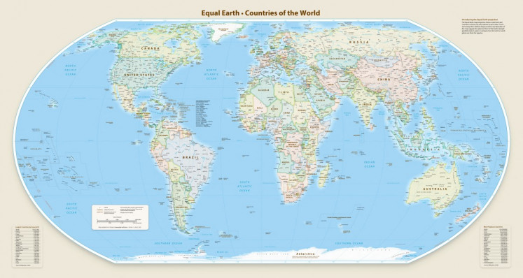
The United Nations General Assembly adopted a new world map on Friday, altering the size of continents to provide a more accurate representation of the world. The map, called the Equal Earth cartographic projection, enlarges Africa, Latin America, South Asia, and Oceania while reducing the size of North America and Europe. This change sparked controversy, particularly from the United States, which voted against the resolution.
The US representative argued that focusing on map projects distracts from addressing more pressing global issues. The new projection, developed in 2018, aims to accurately depict the relative sizes and shapes of continents, addressing the inaccuracies of the traditional Mercator projection, which was designed for maritime navigation in 1569.
France, a co-sponsor of the resolution, announced it would abandon the Mercator projection, noting that under the old map, the United States, Russia, and China appeared disproportionately large compared to other regions. The initiative reflects France's efforts to enhance relations with Africa, especially with former colonies that have strained ties.
Written by urgent.news from The Jakarta Post's reporting — not their text. Machine-written — may contain errors; check the original before relying on it.