'A worrying snapshot': Satellite image shows large patches of open water less than 40 miles from the North Pole
An image from NASA Worldview shows how brittle Arctic sea ice is becoming due to global warming, with large patches of open water visible near the North Pole on Aug. 29.
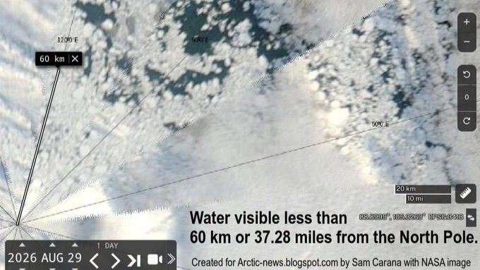
Recent NASA satellite imagery reveals extensive areas of open water just 37 miles from the North Pole, sparking concern over climate change's impact on the Arctic. While this doesn't necessarily indicate worse ice conditions this year, the observation highlights the region's severe vulnerability to climate change. Experts note that while open water appears at the North Pole occasionally, this particular extent is unprecedented.
The time of year also contributes to the phenomenon, as sea ice tends to be more fragmented and susceptible to gaps in early September. Satellite images over the past two weeks show dramatic shifts in open water locations and amounts near the North Pole. Although the current sea ice extent isn't unusually low compared to record years, the ice's increased fragility due to thinning is making these changes more frequent.
Scientists expect sea ice to refreeze by late September, but the rapid changes in the Arctic Ocean's landscape could have far-reaching effects on local weather, marine ecosystems, and Arctic communities.
Written by urgent.news from Live Science's reporting — not their text. Machine-written — may contain errors; check the original before relying on it.