Satellite Radar Detected a Himalayan Slope Accelerating Weeks Before Nepal's Catastrophic Flood
Learn how radar revealed weeks of movement before the Nepal collapse and what nearly two centuries of glacier loss show about Langtang.
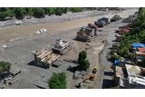
On August 26, 2026, the Trishuli River in Nepal surged upwards by as much as 30 feet in just half an hour, carrying mud and boulders into nearby communities, according to the International Centre for Integrated Mountain Development. The flood's origin lay in Langtang National Park, near Nepal's border with Tibet, where researchers discovered that a significant portion of the slope had been accelerating for several weeks prior to the disaster.
Although satellite radar data revealed this change, it was insufficient to predict precisely when the slope would fail. By September 3, 2026, the catastrophic flood had claimed at least 1,252 lives and left over 4,200 people missing in Nepal. The disaster has raised questions about the role of climate change, as a separate study found that Langtang's glaciers have been shrinking, thinning, and breaking into smaller fragments over the years.
Written by urgent.news from Discover Magazine's reporting — not their text. Machine-written — may contain errors; check the original before relying on it.