Satellite images show bedrock and glacier collapsed on Nepal-China border, then rivers flooded
Satellite images before and after the disaster show where people were living and how the debris had buried villages.
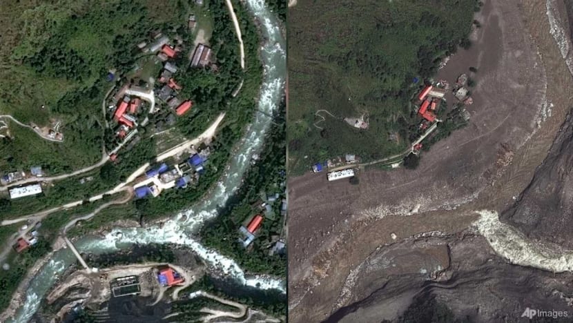
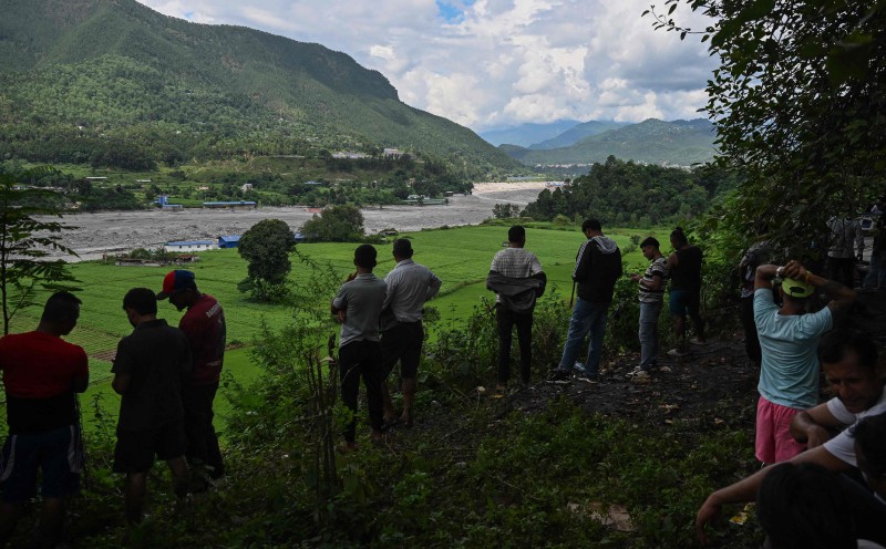
Satellite images revealed where people lived and how debris from a disaster buried villages near the Nepal-China border. Rescue teams searched for survivors after catastrophic flooding, which killed hundreds in Nepal and Tibet, with many more missing, including foreigners and pilgrims. Geomorphologists Kristen Cook and Dan Shugar noted that initial images were clouded, but clearer images showed part of a glacier had broken off from Langtang Lirung peak near the border with Tibet.
The bedrock underneath the glacier collapsed, taking the massive chunk of ice down and sending boulders and ice into the valley. The debris buried villages downstream, and the Trishuli River surged, overtopping its banks and filling with sediment. Towns and villages on the river banks were submerged in debris and mud, with some buildings still visible.
The flooding left a wasteland, requiring many years to recover. Experts believe this is the largest glacier flood they have seen, and they attribute it to climate change, as warming trends have destabilized permafrost and high-altitude rock and ice.
Written by urgent.news from Channel News Asia's reporting — not their text. Machine-written — may contain errors; check the original before relying on it.
This story
This is one outlet's version. Read the fullest account.
- Why a newly formed lake is sparking fears of more flooding along the Nepal-China border apnews.com
- Why a newly formed lake is sparking fears of more flooding along the Nepal-China border news.mongabay.com
- Nepal-China border: Why a newly-formed lake is sparking fears of more flooding timesofindia.indiatimes.com
- Landslide lake overflows on Nepal-China border renews fears of another deadly flood thevibes.com
- Why a newly formed lake is sparking fears of more flooding along the Nepal-China border phys.org
- Lake overflows on Nepal-China border, sparking panic and halting rescue channelnewsasia.com
- Satellite images show bedrock and glacier collapsed on Nepal-China border, then rivers flooded gulfnews.com
- Why a newly formed lake is sparking fears of more flooding along the Nepal-China border winnipegfreepress.com