Satellite images reveal scale of flood devastation in Nepal villages
Before-and-after images show villages, bridges and a key Nepal-Tibet border crossing washed away by devastating floodwaters.
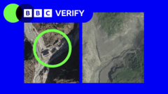
Satellite images have highlighted the extensive destruction caused by Nepal's flash flood, triggered by a glacier collapse along the Trishuli River. The images, captured by US-based intelligence firm Vantor, show the extent of the devastation in the valley, where villages, bridges, and hydroelectric power stations were swept away.
Hundreds have been killed, with thousands remaining missing. The flood's impact was particularly severe in key Nepal-Tibet border crossing area, which was almost entirely washed away, as seen in the satellite images. The floodwater surged more than 2.5km upstream, reaching 100m above the original water line. In the village of Timure, the entire settlement disappeared, with houses and structures now covered in mud and debris.
Downstream, the village of Syapru Besi was also heavily damaged, with houses and infrastructure obliterated. Trishuli town, struck by the flood's force, showed a collapsed bridge and people fleeing in distress. A barrier lake formed at the landslide's base, posing a risk of further flooding and complicating rescue efforts. The stability of the lake and its potential for sudden drainage remain unclear.
The extent of damage on the Tibetan side of the border, a region under strict Chinese control, is still unknown, as foreign media access is heavily restricted. The satellite imagery, published by Vantor's Open Data Program, aims to assist authorities in locating missing persons, rescuing survivors, and recovering the deceased.
Written by urgent.news from BBC News's reporting — not their text. Machine-written — may contain errors; check the original before relying on it.
This story
This is one outlet's version. Read the fullest account.