Satellite images reveal scale of flood devastation in Nepal villages
Before-and-after images show villages, bridges and a key Nepal-Tibet border crossing washed away by devastating floodwaters.
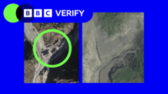
New satellite imagery has unveiled the devastating impact along Nepal's Trishuli River following Wednesday's deadly flash flood. Triggered by a glacier collapse, the flood caused extensive damage, destroying villages, bridges, and hydroelectric power stations. Hundreds of lives were lost, and thousands remain missing, according to Nepalese officials.
The BBC Verify reviewed satellite images from US-based firm Vantor, showing the extent of the devastation. In areas where the river surged through, entire villages and bridges were obliterated. The floodwater and debris reached over 100 meters above the initial impact zone, with damage extending more than 2.5 kilometers upstream.
Timure, a village near the site, has largely disappeared. The steep valley walls, reaching up to 50 meters above the water line, now reveal that most houses on this slope are gone or covered in mud. Further downstream, the village of Syapru Besi is covered in mud, rock, and debris, with structures like bridges and a hydroelectric power station vanishing entirely.
Trishuli, one of the most affected villages, shows an entire neighborhood washed away in satellite images. Verified videos depict a collapsing bridge as the river surges, people crying out in distress, and trying to flee. Inside a bus, footage shows individuals sheltering in a house, looking over a balcony as the floodwater rushes past, knocking debris and a vehicle towards the building. Remarkably, the house remains intact, and survivors can be seen standing in mud after the water recedes.
Satellite provider Planet Labs' imagery offers a clearer view of the disaster's origins. A verified drone video captures a massive chunk of the glacier collapsing, creating a path of rock and debris that the rushing water flowed through. At the base of the landslide, trees and vegetation have been stripped away at heights over 300 meters above the riverbed.
Satellite images also reveal a barrier lake forming at the base of the landslide, which Chinese authorities warn could pose a significant risk of further flooding and complicate rescue efforts. However, the stability of this lake remains uncertain, as Dr. Argha Banerjee, a glaciologist at the Indian Institute of Science Education and Research, could not determine its future behavior based on the images.
While the extent of damage on the Tibetan side of the border remains unclear, it is a region with restricted foreign access. Satellite imagery from Vantor serves as an initial assessment to help aid authorities locate the missing, rescue survivors, and recover the dead.
Written by urgent.news from BBC World's reporting — not their text. Machine-written — may contain errors; check the original before relying on it.