CNA Explains: What caused the deadly Nepal-Tibet disaster?
A high-altitude collapse of rock and glacial ice sent a fast-moving mass of debris and water down narrow Himalayan valleys. Scientists are working out what triggered the collapse – and whether climate change played a role.
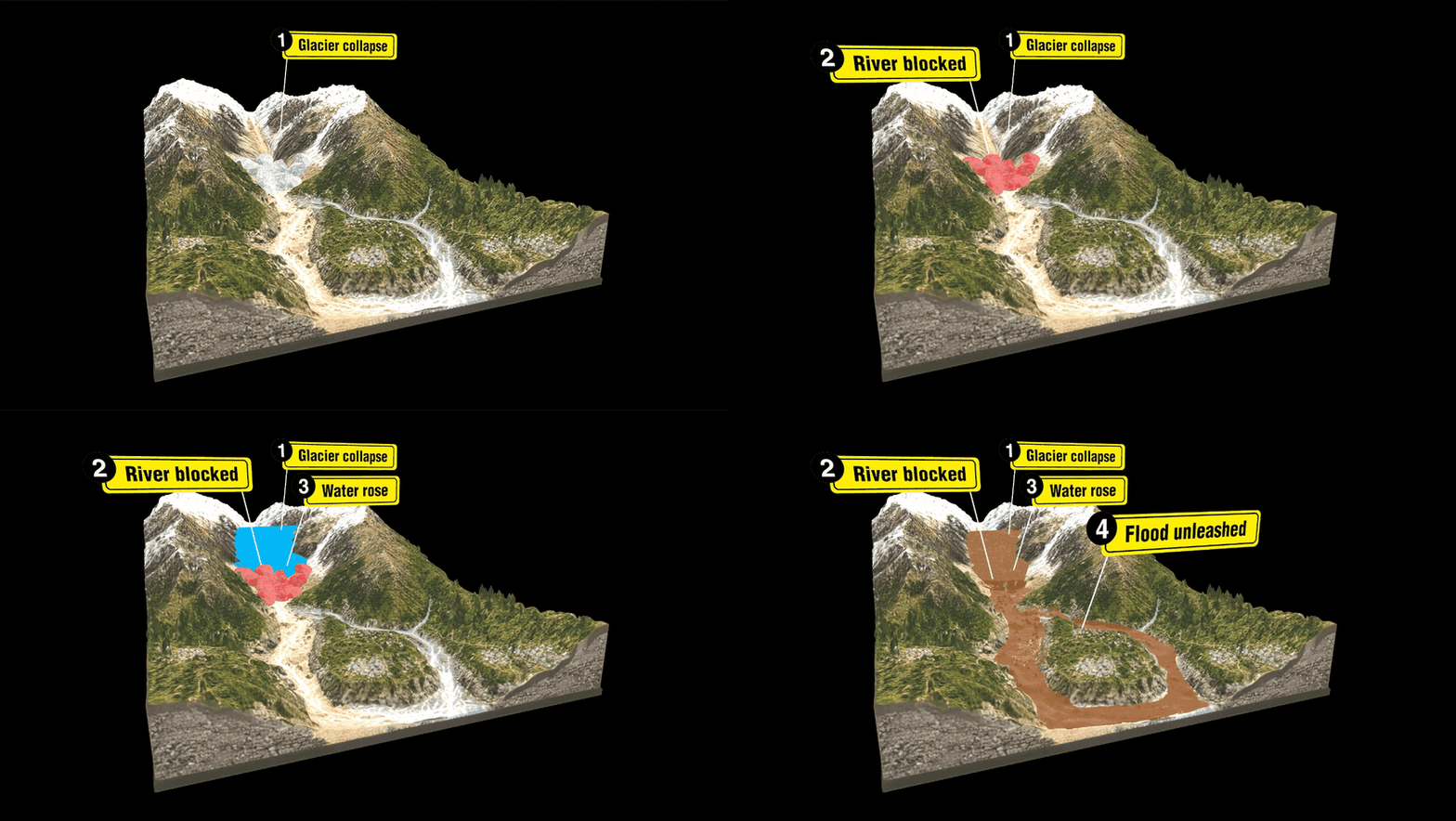
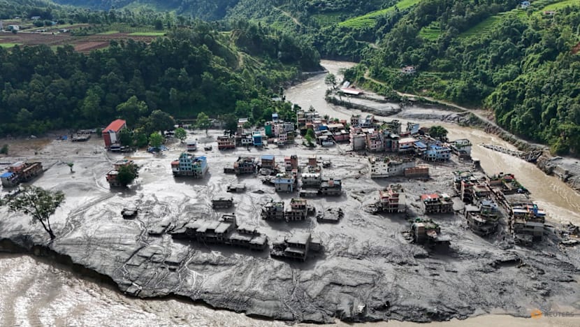
On Wednesday morning, a catastrophic series of flash floods and landslides struck the Nepal-Tibet border region, originating in the high-altitude peaks of the Himalayas. The disaster was triggered by a massive avalanche of ice, rock, mud, and water that swept through villages and a border port, leaving at least 500 people dead and nearly 2,000 missing, including numerous tourists and pilgrims.
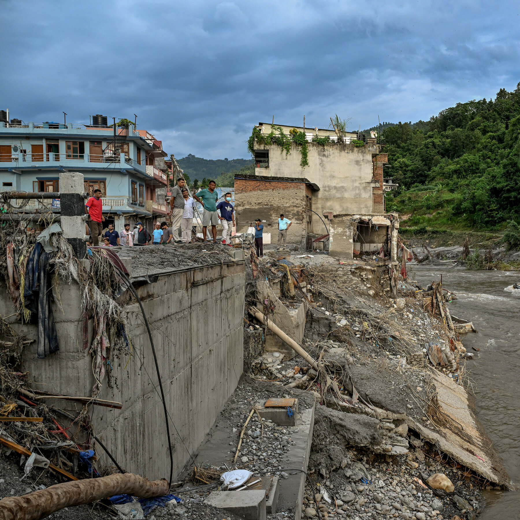
Entire communities were obliterated in mere seconds, with roads, bridges, and power stations reduced to rubble as a torrent of water, ice, mud, and rock rushed through the Himalayan valleys, flattening structures and engulfing vehicles.
Surveillance footage from Gyirong Port captured the initial moments of the disaster, revealing a large, brown mudflow surging down the canyon from the Nepali side of the border and engulfing the port building and those attempting to escape. Satellite images of the region also revealed the dramatic expansion of the rivers' borders.
Initially, the disaster was attributed to a 4.4-magnitude earthquake, but later analysis by the United States Geological Survey determined that the seismic energy was generated by the collapse and subsequent debris flow.
The lack of significant rainfall prior to the disaster posed a challenge for conventional flood-warning systems, which typically rely heavily on rainfall data. Hydrologist Hatim Sharif from the University of Texas San Antonio explained that the absence of rain before the event would have undermined these systems. The extreme topography of the Himalayas exacerbated the situation, as steep slopes accelerated the downhill movement of material, while narrow valleys channeled the flow towards nearby settlements.
Scientists caution that it is too early to directly attribute the collapse to climate change. However, they suggest that warming temperatures could be making the Himalayan landscape less stable. University of Dayton geosciences professor Umesh Haritashya explained that frozen water in cracks within the mountains acts as a "glue" that helps hold rocks and soil together. As the climate changes and warms, this "glue" is melting, potentially weakening the mountain structure.
Authorities have issued warnings of further flooding from dammed lakes upstream of the disaster sites. The debris from the initial disaster has blocked the Bhote Koshi River, creating a new lake whose water is building up behind the new barrier. There is a high risk that the dam could breach, sending a new surge of water downstream.
Rescue operations in Nepal and Tibet were temporarily halted on August 28 due to an upstream dammed lake overflowing, but resumed later that day. The ongoing risk of further disasters poses a significant threat to rescue efforts and those still missing.
Written by urgent.news from Channel News Asia's reporting — not their text. Machine-written — may contain errors; check the original before relying on it.