Before and after: Nepal’s green mountainside turned into debris field
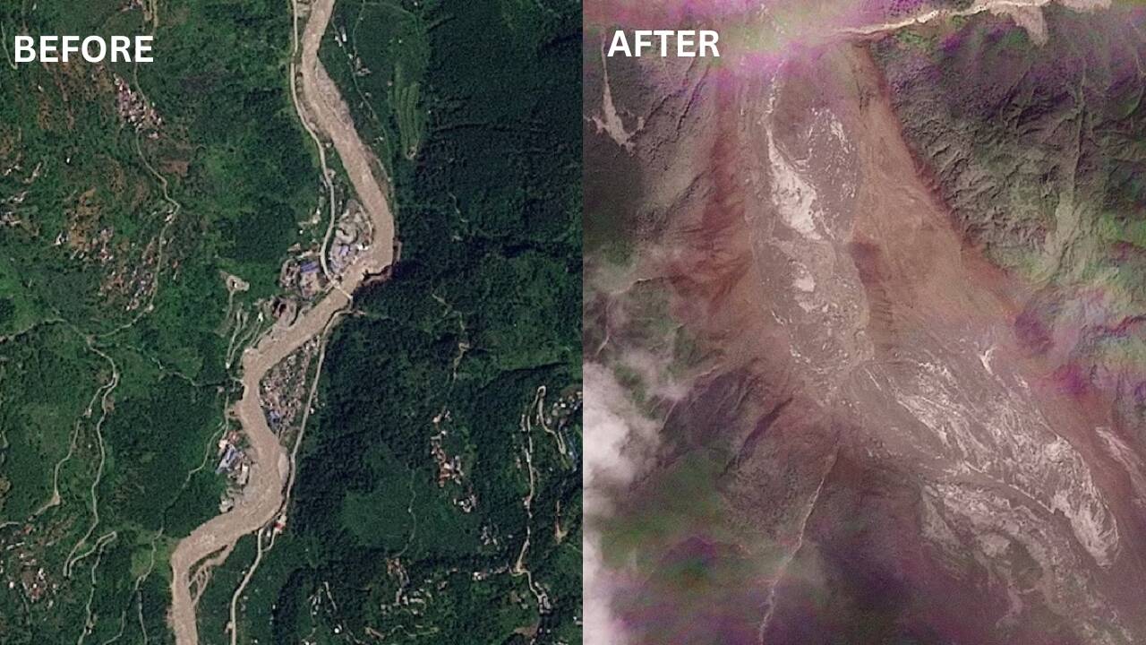
Satellite images captured by Planet Labs before and after a deadly flash flood near Nepal’s border with Tibet showcased a dramatic transformation in the landscape. The green mountainside, previously visible, was now overtaken by a vast expanse of brown debris and sediment. Experts deduced that the lower section of a glacier broke away high up in the mountains, plummeting hundreds of meters into the valley below, likely taking rocks and sediment along with it.
Initially, an earthquake was speculated as the trigger, but the US Geological Survey later confirmed that the recorded seismic activity stemmed from the collapse itself, rather than a separate quake. Engineering geology specialist Vikram Gupta from Sikkim University noted that the satellite evidence pointed to the glacier’s lower end as the point of collapse, where a significant portion of the glacier had likely broken away and entrained rock and sediment.
Earth scientist Dan Shugar from the University of Calgary traced the disaster to a glacier high above the valley, stating that the lower part of the glacier broke off around 5,200 meters and crashed onto the valley floor about 1,200 meters below. This caused an ice-rock avalanche that sent a destructive surge downstream, carrying water, sediment, and boulders through the river systems.
Comparisons of satellite images from August 25 and 26 revealed the extent of the destruction, highlighting the impact on communities along the Bhote Koshi, including Rasuwa and nearby districts, as well as the broader region affected by the flood.
Written by urgent.news from Times of India's reporting — not their text. Machine-written — may contain errors; check the original before relying on it.