Satellite images show mine drainage nearing North Korea’s Kangnyong Bay
Satellite imagery shows yellow-tinted mine drainage spreading from North Korea’s Bupo mine toward farmland and a saltworks in South Hwanghae province’s Kangnyong county, with the contaminated runoff reaching waterways connected to Kangnyong Bay and raising concerns it could eventually leak into the Yellow Sea. The mine’s drainage flows toward the Bupo reservoir and nearby farmland, […]
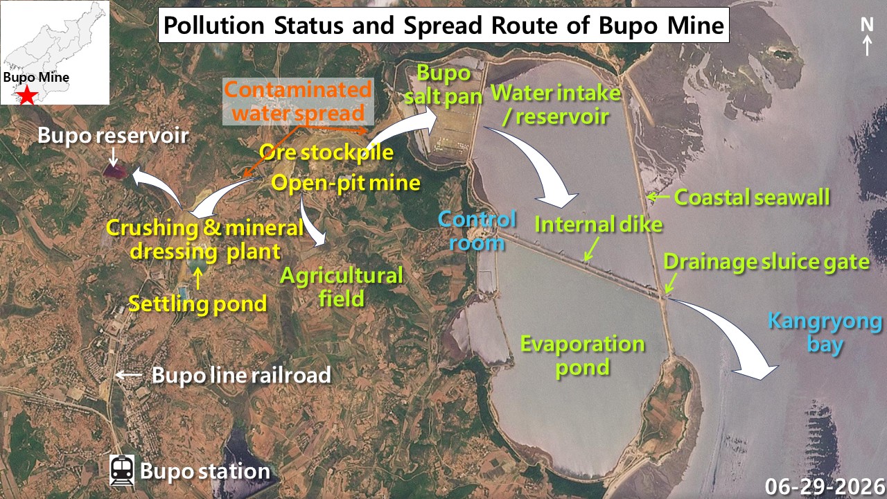
Satellite imagery has revealed yellow-tinted mine drainage from North Korea's Bupo mine spreading towards farmland and a saltworks in South Hwanghae province's Kangnyong county, with concerns that the contaminated runoff could eventually reach Kangnyong Bay and potentially the Yellow Sea. The mine's drainage flows toward the Bupo reservoir and nearby farmland, potentially impacting soil and water quality.
If the runoff reaches the Bupo saltworks, it could disrupt salt production. The tidal flat waterways near the mine connect to Kangnyong Bay through drainage sluice gates, increasing the likelihood of mine contamination reaching the sea.
Brief written by urgent.news from Daily NK's own syndicated text. Machine-written — may contain errors; check the original before relying on it.