In 2014, scientists set off 23 blasts to map magma beneath Mount St. Helens
In a groundbreaking study, researchers utilized controlled explosions paired with seismic technology to investigate Mount St. Helens' subterranean magma systems. They discovered a magma-reservoir located between four to fifteen kilometers deep. This extensive analysis employed numerous instruments to track seismic waves within the volcano, yielding vital knowledge about magma movements. Such…
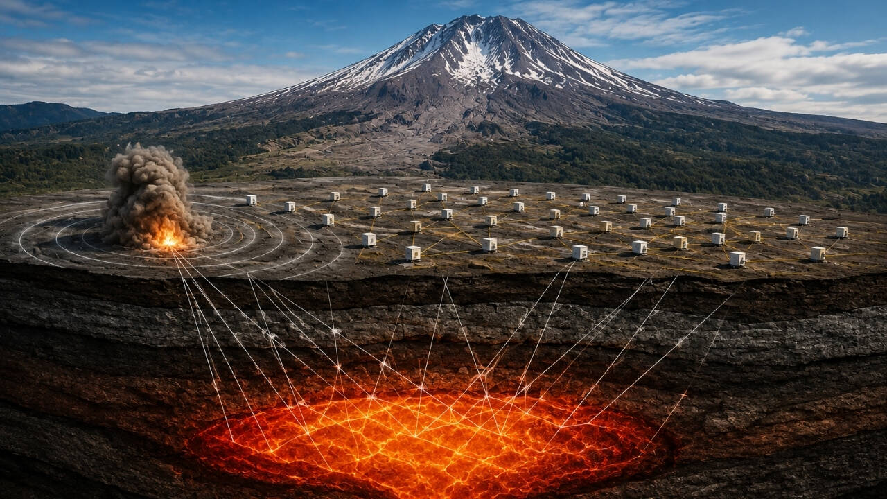
In 2014, scientists conducted a groundbreaking experiment to map the magma beneath Mount St. Helens. This project, part of the Imaging Magma Under St. Helens (iMUSH) initiative, aimed to reveal the complex system of magma and rock hidden beneath the volcano. Utilizing 23 controlled explosions and a dense network of seismic instruments, researchers sent waves through the ground to create a detailed map of the underground structures.
The experiment, involving about 70 people, generated seismic waves from 23 blasts at various distances from the volcano. These waves traveled at different speeds through different types of rock, allowing scientists to construct an image of the underground structure by measuring how quickly the waves arrived at numerous recording stations.
The data, combined with later seismic studies, identified an upper-crustal magma-storage zone roughly 4 to 15 kilometres beneath the volcano. This discovery provided new insights into the volcano's plumbing system and its history of powerful eruptions, including the catastrophic 1980 event.
Written by urgent.news from Times of India's reporting — not their text. Machine-written — may contain errors; check the original before relying on it.
This story
This is one outlet's version. Read the fullest account.
- 23 blasts reveal Mount St. Helens’ hidden magma economictimes.indiatimes.com