NASA Data Feeds River Forecasts as Snow Drought Effects Linger
NASA Earth science data is supporting machine-learning forecasts that inform decisions about water, power, and public safety in Washington state.
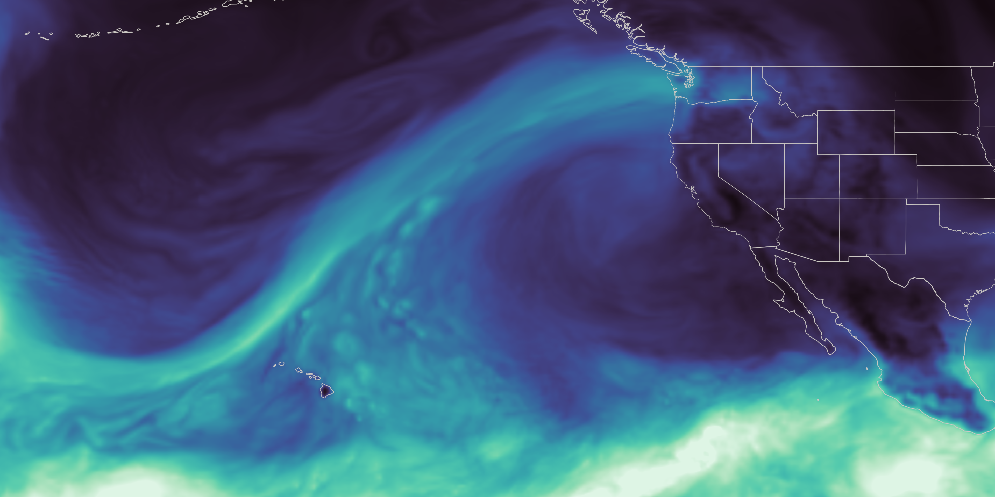
Earth Explore Science discusses how NASA's data is being utilized to predict river flows during the ongoing snow drought in the western United States. The map created using NASA's GEOS system showcases an atmospheric river that impacted Washington state in December 2025, with extreme rainfall and minimal mountain snowfall.
NASA's Scientific Visualization Studio has been involved in developing machine-learning forecasts that assist in decision-making related to water, power, and public safety in Washington. The utility company, Tacoma Power, is currently employing Upstream Tech's HydroForecast to anticipate river flow changes in the Cowlitz River.
HydroForecast incorporates weather predictions, river measurements, and NASA-produced satellite data on snow cover and vegetation conditions to forecast river flow over short periods. The forecasts are updated every two hours, providing valuable information to reservoir managers, hydropower producers, water utilities, and government agencies.
Erin Urquhart, manager for NASA's Water Resources program at the agency's headquarters in Washington, D.C., emphasizes that NASA's mission is to make space observations beneficial on the ground. The agency's freely available data is being incorporated into forecasts by a U.S. technology company, enabling better preparation for storms, reservoir water releases, and navigating dry periods.
Written by urgent.news from NASA's reporting — not their text. Machine-written — may contain errors; check the original before relying on it.
This story
This is one outlet's version. Read the fullest account.
- NASA Data Feeds River Forecasts as Snow Drought Effects Linger science.nasa.gov