Why Earth Looks More Like a Potato Than a Perfect Sphere
Learn more about the true shape of our planet and the mission behind this exact imaging.
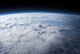
Many believe Earth is a perfect sphere, but the truth is, our planet is more potato-shaped than spherical. The European Space Agency's GOCE mission, along with other data from NASA, has revealed that Earth's actual shape is not flat, nor is it perfectly round. In reality, Earth looks like a potato.
One factor contributing to Earth's potato-like shape is its slightly thicker equator, which results from the planet's rotation. However, at a more detailed level, Earth's surface is uneven and irregular. Mountains, hills, valleys, and plains are scattered across the globe. Since mountains and hills contain denser materials than valleys, gravity varies across the planet. Where the planet is denser, gravity is slightly stronger, pulling with greater force.
This gravitational pull has noticeable effects on Earth's surface, particularly on its liquid component - our oceans. The moon and sun also tug on these waters, causing tides. But if we could remove the tides from the oceans, the ocean surface would become a smooth, irregular surface. Higher gravity areas would pull water in, raising the level of this theoretical tideless sea. Conversely, areas with weaker gravity would have lower sea levels.
To model Earth's shape more accurately, scientists extend this hypothetical sea level all across the planet's surface, reflecting the differences in gravity's strength across land. This results in a shape called the geoid, which illustrates how gravity warps Earth's surface, according to NASA. However, the geoid is not a smooth and regular surface. In fact, it's quite irregular.
The geoid is exaggerated in the images, with differences in height multiplied by 10,000 times. In reality, the difference between the highest and lowest points on the geoid is only about 656 feet (200 meters). The geoid's highest peak is found in Iceland, at 278 feet (+85 meters), while its lowest point is in the Indian Ocean, at -347 feet (-106 meters).
The GOCE mission, which mapped Earth's gravity, found that the weakest gravity areas on Earth are in the Indian Ocean, covering an area roughly the size of India. Scientists believe that deep structures within Earth's mantle may have contributed to this gravity anomaly, but its true origin remains unclear. Nonetheless, the geoid is a valuable tool for scientists who want to calculate exact surface elevations worldwide, and it is computed using powerful gravity field models, such as GOCO06s, which is derived from data collected by 19 different satellites over 15 years.
Written by urgent.news from Discover Magazine's reporting — not their text. Machine-written — may contain errors; check the original before relying on it.