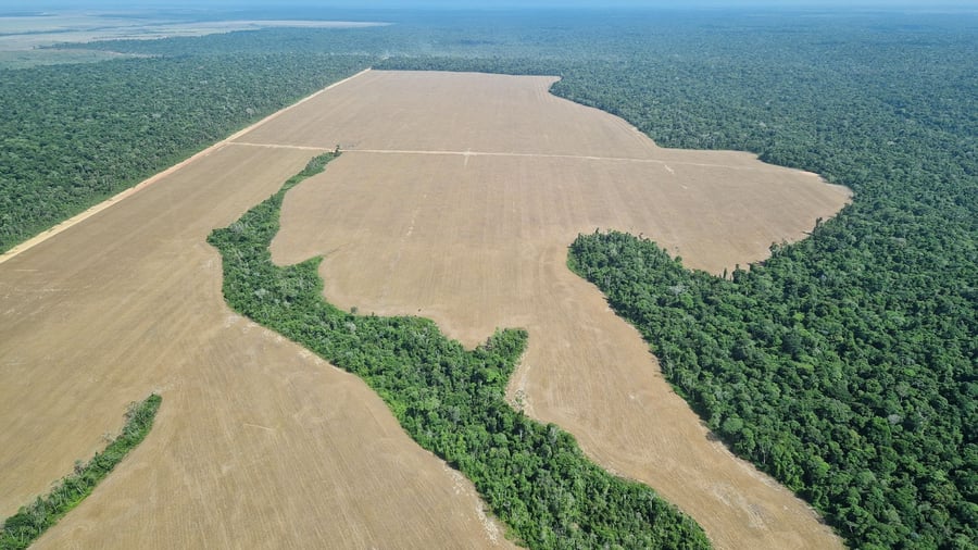
Amazon deforestation alerts fall to lowest level since 2013, Brazilian data show
Deforestation in the Brazilian Amazon has fallen to its lowest level in 13 years, according to new satellite data from Brazil’s National Institute for Space Research (INPE), continuing a decline that began after President Luiz Inácio Lula da Silva returned to office in 2023. INPE’s DETER alert system detected 2,874 square kilometers (1,110 square miles) […]

Brazilian satellite data from the National Institute for Space Research (INPE) reveals a sharp decline in Amazon deforestation, falling to its lowest level in 13 years, according to a recent report. Between August 2025 and July 2026, the DETER alert system detected 2,874 square kilometers (1,110 square miles) of deforestation, marking a 36% decrease from the previous 12-month period and a 55.6% drop from the average of the past decade.
This represents the lowest level since the current DETER system was introduced in 2015, with the last reduction recorded in 2012/13, at 2,766 square kilometers. The DETER system functions as a rapid-response mechanism for enforcement agencies, leveraging satellite imagery to swiftly identify new forest clearing, allowing authorities to investigate and intervene effectively.
While the system differs from INPE’s PRODES, which offers a higher-resolution annual monitoring system and serves as the basis for Brazil’s official deforestation rate, the latest DETER figures suggest a further reduction in clearing activities. If PRODES also indicates a similar decline, Brazil might record its lowest official Amazon deforestation.
Written by urgent.news from Mongabay's reporting — not their text. Machine-written — may contain errors; check the original before relying on it.