Thunderstorms and flash flood risk on final day of UK heatwave
More places in southern and eastern England are expected to reach heatwave criteria on Tuesday but cooler temperatures are on the horizon.
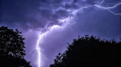
The UK is currently experiencing a heatwave with temperatures reaching over 30C in some areas, leading to amber and yellow heat health alerts across much of England until Wednesday. However, a cold front is expected to move southwards during Tuesday, bringing scattered showers and thunderstorms to parts of the country, including London, Essex, Kent, and Surrey.
While these showers may provide some relief, they are unlikely to alleviate the ongoing drought. The Met Office has issued a yellow thunderstorm warning for Northern Ireland, with up to 30mm of rain possible in an hour, along with strong winds and hail. Following the heatwave, forecast models suggest that August will also bring more of the same, with low rainfall and above-average temperatures, meaning hosepipe bans are unlikely to be lifted soon.
Brief written by urgent.news from BBC News's own syndicated text. Machine-written — may contain errors; check the original before relying on it.