The valley-blocking Wanlixi landslide in Taiwan
In Taiwan, a large rockslide last month, the Wanlixi landslide, has blocked a river, creating a barrier lake with a volume of about 6 million cubic metres. In Taiwan, a large landslide has blocked the Wanli river in Hualien County. The hazard is being actively monitored by the Forestry and Nature Conservation Agency, who are […]
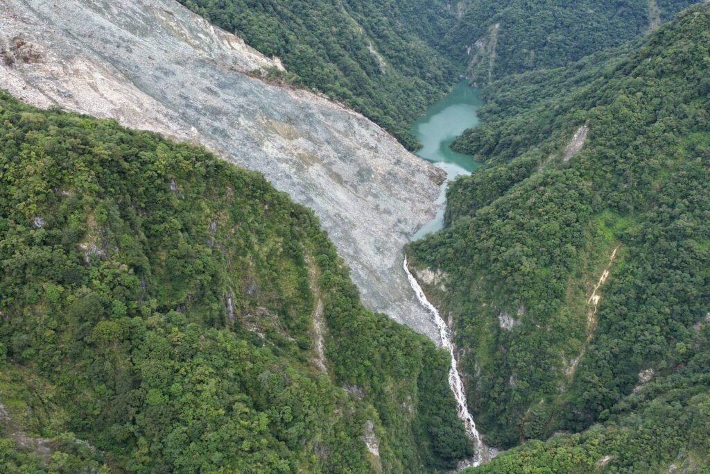
In recent months, a significant rockslide, known as the Wanlixi landslide, has occurred in Taiwan, obstructing the Wanli river in Hualien County. The Taiwan Forestry and Nature Conservation Agency is closely monitoring this hazard, which they refer to as the Wanlixi landslide. The landslide dam was first identified on June 21, 2026, with a Planet Labs image from June 20, 2026, revealing the slope was intact, albeit with signs of deformation. The precise location of the landslide is at coordinates 23.78859° N, 121.27236° E.
The landslide created a reservoir with an estimated volume of 6 million cubic meters, as highlighted in the Forestry and Nature Conservation Agency's 30th July 2026 update. Despite the lake overtopping the dam, the natural spillway remains in a stable overflow state at present, with low rainfall input to the system. The Forestry and Nature Conservation Agency reports that the lake is being actively monitored 24 hours a day, ensuring downstream communities are aware of the potential need for action.
While not as impactful as some of the featured landslides, the Taiwan government is exercising caution in managing the risk. The Matai'an landslide, which took place last year, is also visible in a Google Map that shows the downstream geography. The landslide is located northwest of the map's central point.
Written by urgent.news from Eos's reporting — not their text. Machine-written — may contain errors; check the original before relying on it.