NASA’s New 3D Model Shows the Earth Is a Lumpy Mess
We like to think of our home as a nice, smooth sphere. But mapping the Earth’s gravitational field provides a different view of the planet.
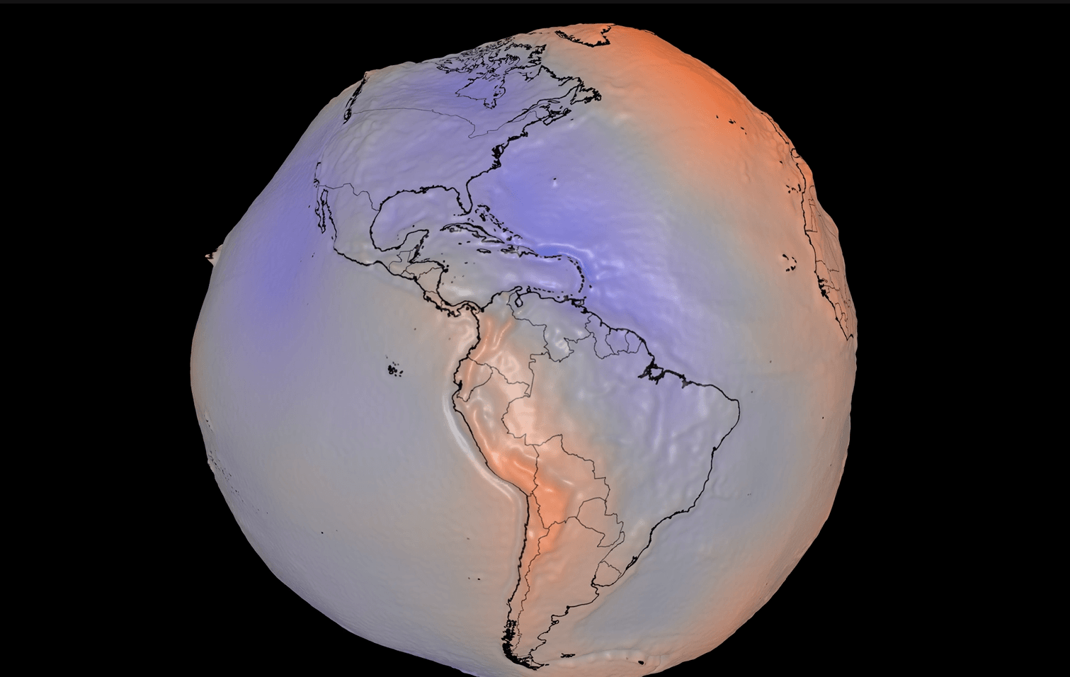
NASA has unveiled a new 3D model revealing the complex shape of our planet, illustrating Earth as a lumpy and irregular entity. This depiction stems from the gravitational field's variations caused by the uneven distribution of mass within the planet. To visualize this, NASA has exaggerated the geoid, or the surface a global ocean would take if dictated solely by Earth's gravity and rotation, by magnifying its heights by a factor of 10,000.
This intricate model was constructed using satellite data that can detect minute differences in gravity across locations. The dataset, spanning 15 years and incorporating a billion observations, is now available for public exploration in an interactive 3D format. While this striking imagery may provoke thoughts about Earth's roundness, the real significance lies in its practical applications.
Understanding gravity's nuances is crucial for monitoring the accelerating loss of ice in Antarctica and Greenland due to global warming. NASA's Gravity Recovery and Climate Experiment (GRACE) satellites have contributed to quantifying the ice loss, revealing that Antarctica sheds about 135 gigatons of ice annually, while Greenland loses approximately 264 gigatons.
This information is vital for estimating oceanic rise and predicting future sea-level changes. Moreover, these observations have been instrumental in tracking groundwater depletion and drought patterns worldwide. They have highlighted extensive groundwater depletion in the western United States and beyond, and provided insights into acute droughts, such as the scorching conditions in Spain and France that are fueling wildfires.
According to an analysis from the University of Nebraska, soil moisture and shallow groundwater levels in parts of the region are at or near record lows. As climate change is expected to exacerbate drought conditions globally, these gravitational measurements offer invaluable guidance for water managers in arid areas.
Written by urgent.news from Wired Science's reporting — not their text. Machine-written — may contain errors; check the original before relying on it.