Using LiDAR Lens to examine landslides in the UK
LiDAR Lens is a powerful tool that allows users to view LiDAR imagery for the UK. It highlights landslides spectacularly well, as a couple of examples show. LiDAR Lens is a web service aimed at archaeology that provides access to LiDAR information for the United Kingdom. Run privately by Tim Daw, it is an astonishingly […]
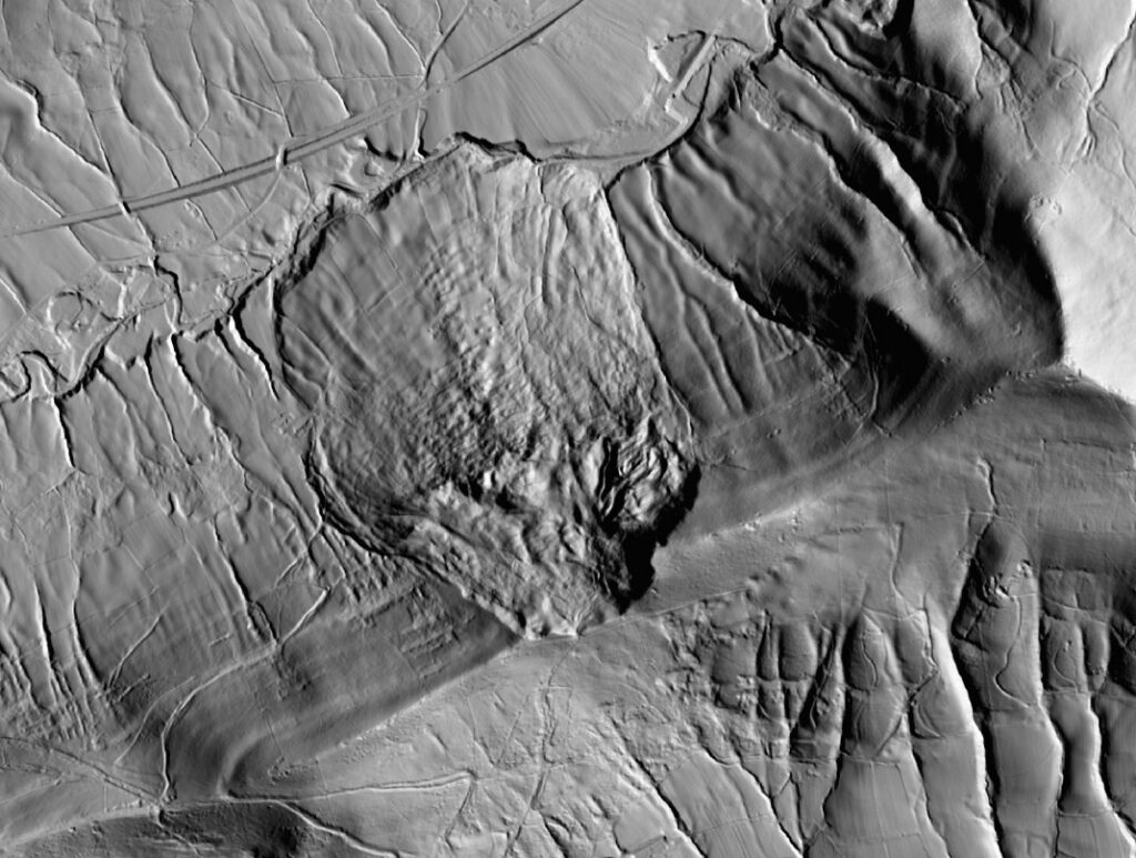
LiDAR Lens is a powerful online tool that allows users to explore LiDAR imagery across the United Kingdom. This tool is particularly adept at highlighting landslides, as demonstrated by two examples in the Peak District.
The first example is located just northeast of the Ladybower dam, with coordinates [53.36553, -1.71400]. In aerial imagery, the landslide is not readily apparent, but when viewed through LiDAR Lens, the relict landslide in the valley is clearly visible. The debris is clearly seen at the bottom of the slope, and a larger landslide complex can be seen to the northwest.
Another example is found in the Hope Valley, with coordinates [53.35681, -1.80089]. Here too, aerial imagery makes the landslide less obvious, but LiDAR reveals a large failure of the ridge and an extensive debris field that extends to the channel. This clearly demonstrates the extraordinary power of LiDAR as a tool for examining landslides.
LiDAR Lens is an accessible and free resource, provided by Tim Daw for archaeological purposes. However, its utility extends far beyond archaeology, as demonstrated by these examples. It provides a clear and easy way to view and understand the distribution of landslides across the UK.
Written by urgent.news from Eos's reporting — not their text. Machine-written — may contain errors; check the original before relying on it.