A medieval map mystery may finally be solved
“We’ll just have to think our way back, step by step.” That’s what the Dutch geodesist Roelof Nicolai said in 2014 in a Strange Maps article . Nicolai had just spent his PhD years discovering that portolan charts — those gorgeous, wind-rose-covered coastline maps that suddenly appeared in Mediterranean ports in the second half of the 13th century — were geometrically too accurate to have been…
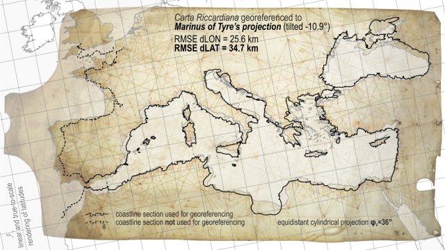
In 2014, Dutch geodesist Roelof Nicolai proposed a mysterious explanation for the extraordinary accuracy of portolan charts, which appeared suddenly in Mediterranean ports in the late 13th century. Now, Croatian geography professor Tome Marelić has used a meticulous step-by-step approach to potentially solve the cartographic conundrum.
Portolan charts, known for their dense web-like networks called rhumb lines, are crisscrossed with harbor names. The oldest surviving example, the anonymous Carte Pisane, was created in Italy around 1270, but its geometric precision has long puzzled historians. Traditional theories, romantic though they may be, suggest that sailors recorded their compass bearings and estimated distances to compile these charts, but this explanation doesn't hold up under scrutiny.
The geometric accuracy of portolan charts is far too high to have been achieved through rudimentary surveying methods.
Marelić's solution is to examine the charts as mosaics, assembled from pre-existing chart pieces. By carefully analyzing the accuracy of individual chart sections and comparing them to the whole, he discovered that regional cartographic subunits are much more accurate than the aggregated chart itself. This supports the idea that portolan charts were created by combining various pre-existing maps.
Furthermore, he found that Pietro Vesconte, a Genoese cartographer, produced the most accurate maps on a subsectional level for at least three centuries after the Carte Pisane, suggesting that Vesconte might have been the mastermind behind the portolan chart tradition.
Written by urgent.news from Big Think's reporting — not their text. Machine-written — may contain errors; check the original before relying on it.