Urgent.News

What's breaking now, across thousands of outlets.

Science

Researchers use seasonal satellite imagery to map shrub encroachment in Inner Mongolia grasslands

Researchers from the Aerospace Information Research Institute of the Chinese Academy of Sciences (AIRCAS) used satellite images collected across the growing season to map shrub cover in the grasslands of Inner Mongolia, China. By tracking seasonal differences in growth, they were able to distinguish shrub patches from dense grass, which can look similar in a single image.

Researchers use seasonal satellite imagery to map shrub encroachment in Inner Mongolia grasslands

We haven't written up this one. Phys.org has the full story — the link below goes straight to it.
Read the original at phys.org →

More in Science

AGN SIG Spotlight Series, 17 Nov 2026

Our Spotlight Series highlights recent advances in AGN science, with a strong emphasis on participation from early-career researchers, and includes plenty of time for community discussion following the presentations. The post AGN SIG Spotlight Series, 17 Nov 2026 appeared first on NASA Science .

IR STIG Seminar, 8 Dec 2026

Superconducting Nanowire Single Photon Detector Arrays for Time-Resolved Imaging and Infrared Detection. Speaker: Matthew Shaw, JPL The post IR STIG Seminar, 8 Dec 2026 appeared first on NASA Science .

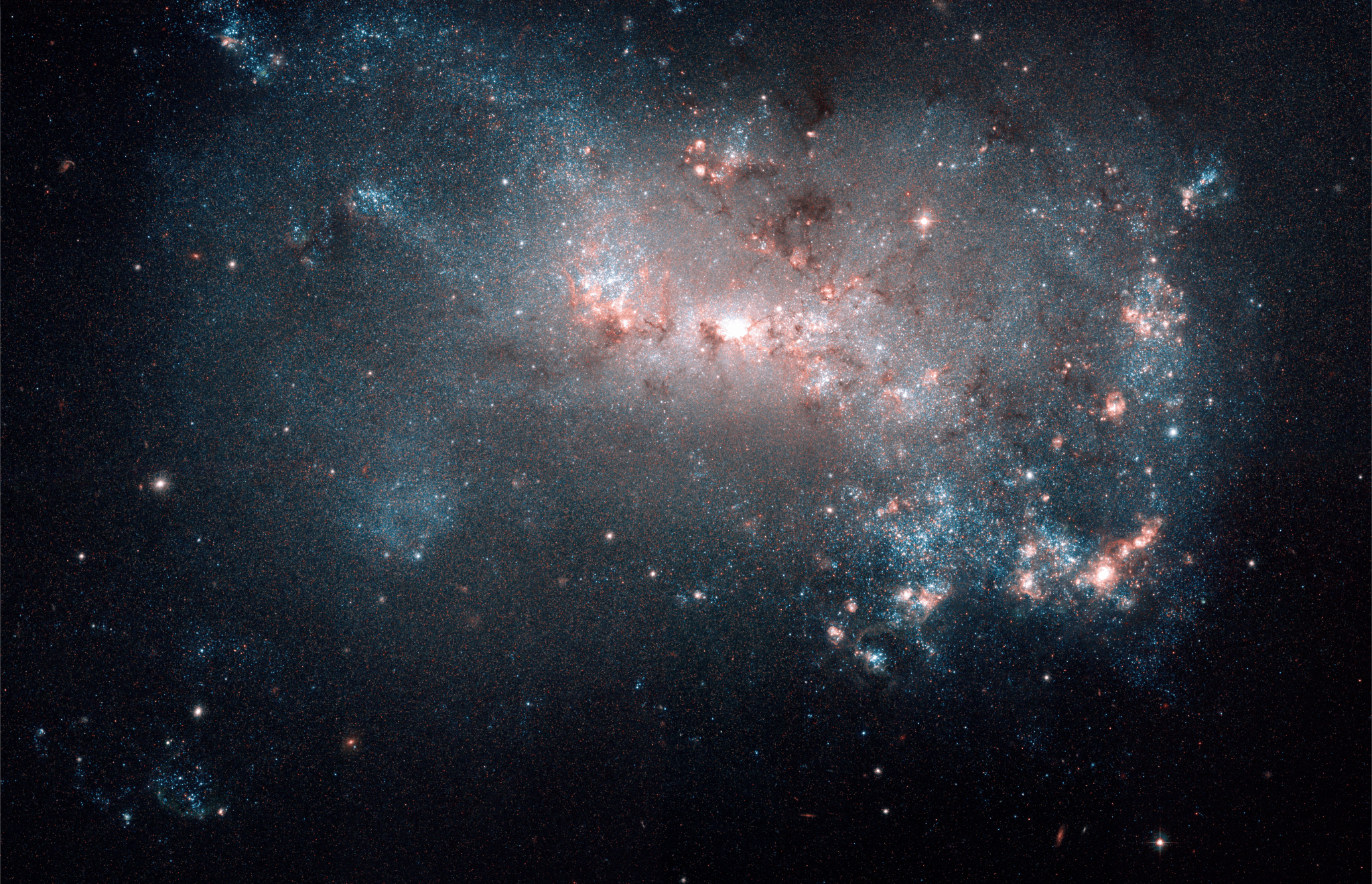
Hubble Reveals Cosmic Mystery

This photo released on Nov. 2, 2026, showcases NGC 4449, a dwarf irregular. Researchers using NASA’s Hubble Space Telescope studied 37 nearby dwarf galaxies — small galaxies containing a few thousand…

Hubble Reveals Cosmic Mystery

This photo released on Nov. 2, 2026, showcases NGC 4449, a dwarf irregular. Researchers using NASA’s Hubble Space Telescope studied 37 nearby dwarf galaxies — small galaxies containing a few thousand to hundreds of millions of stars — including NGC 4449 and found that much of the oxygen they expected to see is missing. Read […]

More from Wednesday 4 November →