Satellite data trace a drainage route from North Korea’s Pyongsan uranium plant to the Ryesong River
Satellite imagery shows a wastewater pond below North Korea’s Pyongsan uranium plant repeatedly expanding and shrinking between February and September 2026. The fluctuations keep alive concerns that toxic runoff from the plant could reach the nearby Ryesong River. After an earlier review of optical imagery, I used radar data to track changes in the pond’s […]
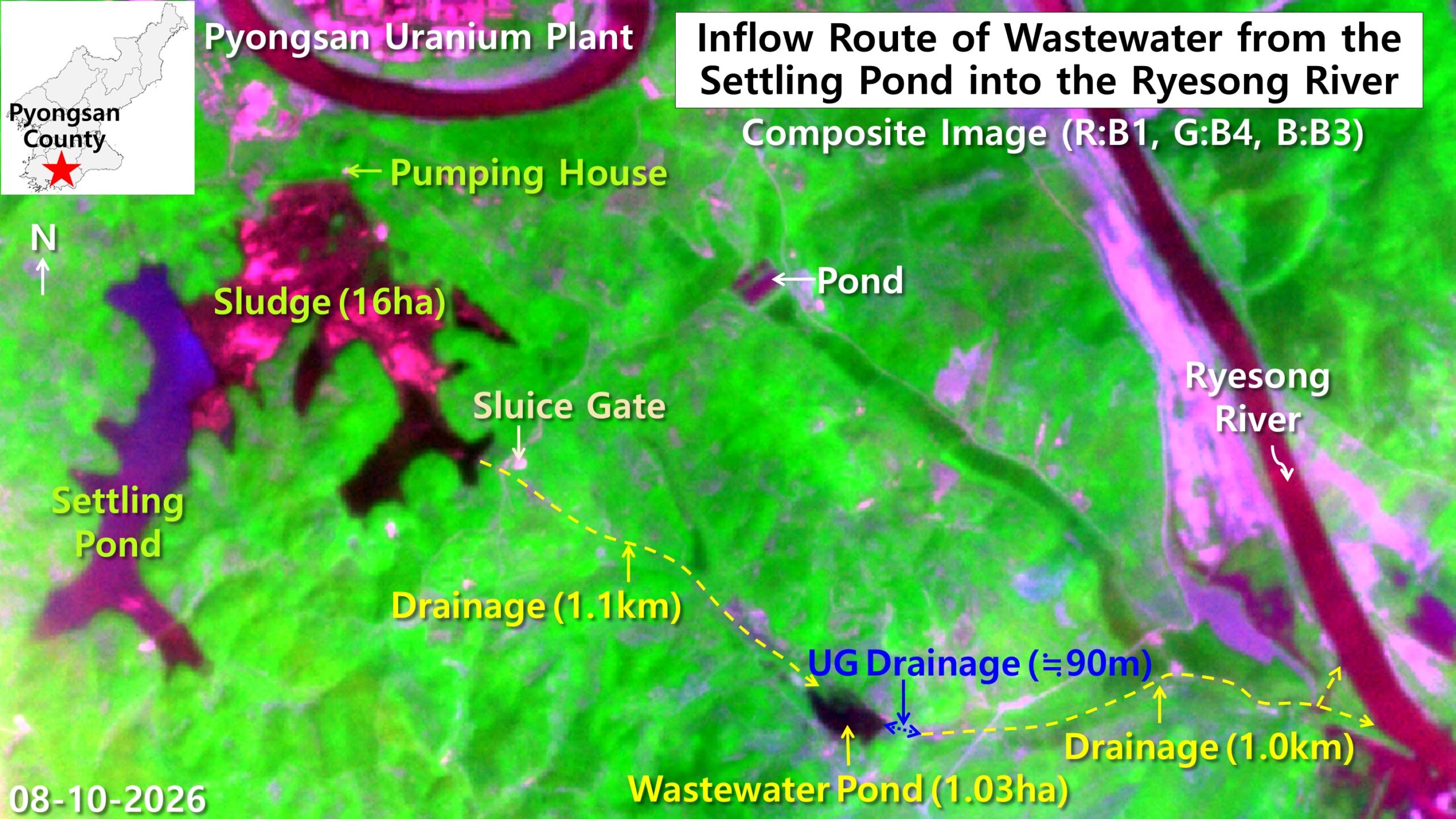
Satellite imagery reveals wastewater from North Korea's Pyongsan uranium plant repeatedly expanding and contracting between February and September 2026. Concerns persist that toxic runoff could reach the Ryesong River. Radar data shows the wastewater pond covering 0.79 hectares on February 25, growing to 1.38 hectares in mid-April, then shrinking to 0.85 hectares by September 24. The pond is believed to be part of a drainage route that could carry material toward the Ryesong River.
Written by urgent.news from Daily NK's reporting — not their text. Machine-written — may contain errors; check the original before relying on it.