Multicolored 'mosaic' of mini farms surrounds Taiwan's largest river — Earth from space
A recent satellite photo shows a patchwork of tens of thousands of size-restricted farms tightly crammed into Taiwan's Yunlin County, which grows a majority of the island's food.
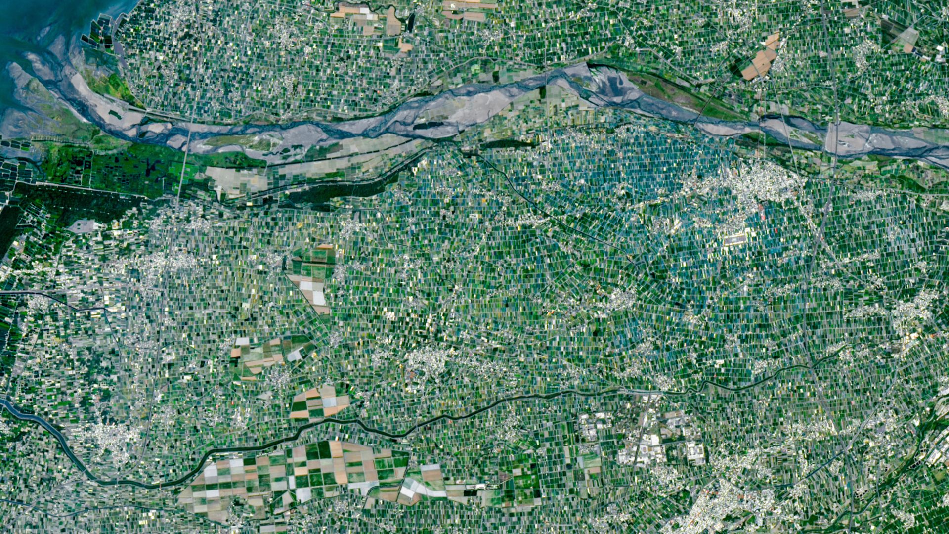
The sprawling countryside surrounding Taiwan's largest river, the Zhuoshui, is a vibrant patchwork of small, tightly packed farms visible from space. The Landsat 9 satellite captured a striking image of the region in April 2026, showcasing the agricultural challenges faced by the densely populated island nation.
Taiwan, slightly larger than Maryland, is home to around 23 million people. This high population density places immense pressure on the island's agricultural sector, with only about 3,200 square feet (300 square meters) of farmland available per citizen—roughly two-thirds the size of a basketball court. This is a mere 10 times less than the agricultural land available per person in the United States.
Yunlin County, located in the western Pacific Ocean, is the heart of Taiwan's agricultural industry. The county, spanning roughly 15 miles (24 kilometers) along the Chianan Plain, boasts ideal conditions for farming thanks to its flat terrain and proximity to the Zhuoshui River. The county's flat ground and water access make it suitable for growing a diverse range of crops, including rice, sweet potatoes, peanuts, corn, sugarcane, garlic, scallions, coffee, fruit, and leafy greens.
The average farm size in Yunlin County is under 100,000 square feet (10,000 square meters), which is around 90 times smaller than the average U.S. farm. This size constraint stems from decades-old legislation limiting the amount of land any individual can own. Most farms are passed down generation to generation.
Two distinct features stand out when examining the satellite image of Yunlin County. First, a cluster of blue and turquoise rectangle-shaped farms surrounds the town of Xiluo in the upper right corner of the image. These farms are enclosed by plastic shade nets that protect them from intense summer sunlight and heavy monsoon rains during the wet season.
The second notable anomaly is a vast field of sugarcane near the town of Baozhong in the lower left part of the photograph. These sugarcane fields were established during Japan's colonial rule of Taiwan, from 1895 to 1945, and were used to cultivate the crop alongside an extensive railway network. Since then, most of the sugarcane fields have been repurposed, with only one remaining railway line in use.
Written by urgent.news from Live Science's reporting — not their text. Machine-written — may contain errors; check the original before relying on it.