Expert: Indonesia needs fire risk maps, food project reevaluation amidst Merauke...
Data from MapBiomas showed that areas with the most extensive fire damage are distributed across various food production hubs and agricultural regions, with Merauke in South Papua topping the list at the regency level.
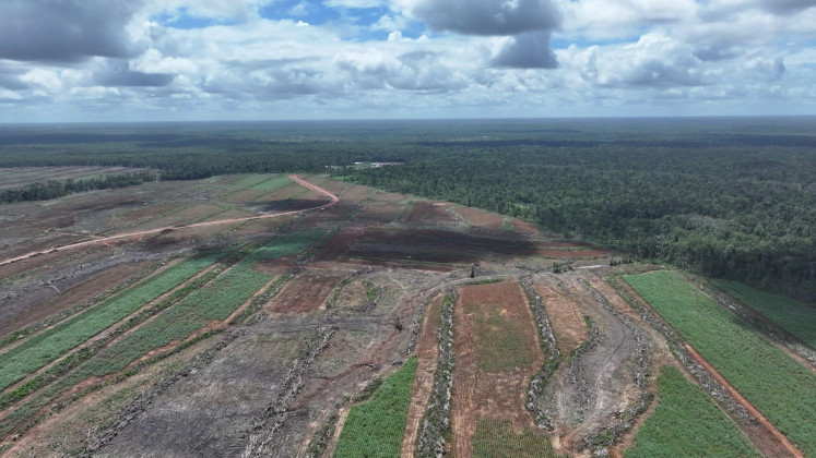
Indonesia is facing a severe wildfire crisis, with data from MapBiomas indicating that the country lost 178,232 hectares of land to fires between January and June 2026, a figure three times larger than initially estimated. The most affected region was Merauke in South Papua, which suffered 8,084 hectares of fire damage, accounting for about 36 percent of all burned areas in national food projects.
Experts have called for the development of fire risk maps for food estates to prevent such large-scale destruction. Ibrahim Fahmi Badoh, director of communications and advocacy at Auriga Nusantara, emphasized the need for these maps and the exclusion of fire-prone areas from project expansion. The MapBiomas report also revealed that 30 percent of the fires occurred in agricultural zones, with 22,703 hectares of burned land located within food project zones.
Written by urgent.news from The Jakarta Post's reporting — not their text. Machine-written — may contain errors; check the original before relying on it.
Also reported by 1 other outlet
- BRIN maps Indonesia's seaweed value chain for added value en.antaranews.com