Friday’s weather: Severe thunderstorms, hail and strong winds forecast for parts of SA
A Yellow Level 2 warning has been issued for severe thunderstorms, excessive lightning, small hail and gusty winds in parts of the Northern Cape and Western Cape.
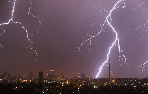
The South African Weather Service has cautioned residents in various regions across the country for Friday, as severe thunderstorms, large hailstones, and strong winds are anticipated in parts of the Northern Cape and Western Cape. The Namakwa District Municipality in the Northern Cape, Central Karoo, and West Coast districts in the Western Cape are particularly at risk due to these hazardous weather conditions. Additionally, extreme fire danger is expected in the north-eastern areas of the Northern Cape.
In contrast, Gauteng will experience partly cloudy skies with warm temperatures and a high UVB sunburn risk. Mpumalanga will start the day with morning fog on the escarpment, transitioning to partly cloudy and cool-to-warm weather. Isolated afternoon showers and thunderstorms are expected in certain parts of the province, except in the extreme south-west.
Limpopo will begin with cloudy skies in the east, evolving into partly cloudy and warm conditions. Isolated afternoon showers and thunderstorms are probable in certain regions. North West Province will start the day fine and warm, changing to partly cloudy in the afternoon with isolated showers and thunderstorms in the eastern parts.
The Free State will enjoy fine and warm weather, shifting to partly cloudy skies in the afternoon. Northern Cape will have partly cloudy and warm-to-hot conditions, with scattered showers and thunderstorms over the southeastern and central areas, as well as widespread showers and thunderstorms in the western parts and southern high ground.
Western Cape will witness partly cloudy mornings over the Little and Central Karoo, followed by widespread showers and thunderstorms in the afternoon. Elsewhere, cloudy and warm conditions with scattered showers and thunderstorms are expected. The western half of the Eastern Cape will have morning fog in some southern areas, progressing to fine and cool-to-warm weather.
It will become cloudy with isolated showers and thunderstorms, although these will be limited along the coast. The eastern half of the Eastern Cape will be cloudy, featuring morning fog patches south of the escarpment. Otherwise, conditions will be fine and warm-to-hot, transitioning to cloudy with isolated showers and thunderstorms.
In KwaZulu-Natal, morning fog is anticipated over the interior, progressing to partly cloudy and warm conditions. Isolated showers and thunderstorms are expected in the extreme south-west and north-east, with very high UVB sunburn conditions in Gauteng and the Western Cape, and high risk in KwaZulu-Natal.
Written by urgent.news from IOL's reporting — not their text. Machine-written — may contain errors; check the original before relying on it.