UCC geologist behind Ireland’s first climate exposure map
As the impacts of climate hazards intensify, I think more people will come to recognise that we are very much part of the natural world, not separate from it. Read more: UCC geologist behind Ireland’s first climate exposure map
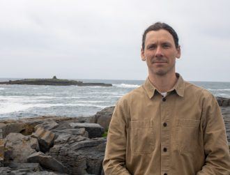
University College Cork PhD student Kevin Walsh is spearheading a groundbreaking project that has created Ireland's first national climate exposure map. This map highlights the country's vulnerability to climate hazards, such as rising sea levels and storm surges. Walsh, a geoscientist and researcher at the University's Digital Environmental Technology for Enhanced Coastal Zone Management (Detect) Project, holds a bachelor's degree in geology and a master's research degree in geospatial analysis and offshore wind energy from UCC.
Motivated by his deep connection to the sea and Ireland's offshore wind farm developments, Walsh decided to delve into climate research. He secured funding for his project through Research Ireland's Postgraduate Scholarship programme. The Detect project, funded by the Environmental Protection Agency (EPA), aims to develop methods for monitoring, modelling, and managing coastal regions.
Walsh's first task was to conduct a comprehensive national assessment of coastal exposure to climate hazards. He combined physical coast features with climatic and metocean variables to determine relative exposure scores and ranks for coastal points across Ireland. The study also identified areas of cultural heritage within these high-exposure zones and evaluated the protective functions of coastal habitats, such as dunes, saltmarshes, and seagrass meadows.
Based on this research, five "Very High Exposure" sites in Clare and Cork were selected for further study. Walsh and his team are now using multi-spectral drones to map these sites monthly, creating highly accurate centimetre-scale elevation models. These models will help detect changes to the beaches and surrounding areas, enabling the creation of "Digital Twins" to test how each site might respond to future climate scenarios.
The research also seeks to improve traditional coastal protection methods by highlighting the protective functions of coastal habitats. While hard structures like seawalls provide local protection, they are expensive and can cause unintended consequences. In contrast, coastal habitats can recover from storms, adapt to sea level rise, and naturally stabilise the shoreline. The study aims to demonstrate the potential increase in exposure if these habitats are lost, providing evidence for their protection or restoration.
Written by urgent.news from Silicon Republic's reporting — not their text. Machine-written — may contain errors; check the original before relying on it.