How 2 US, European Satellites Are Studying Hurricanes During El Niño
Last November, NASA and its European partners launched the Sentinel-6B satellite to improve hurricane forecasts, help protect infrastructure, and benefit commercial industries, including shipping. The satellite now is flying 30 seconds behind its predecessor, Sentinel-6 Michael Freilich. Both satellites are providing precise sea level height measurements during what oceanographers expect to be a…
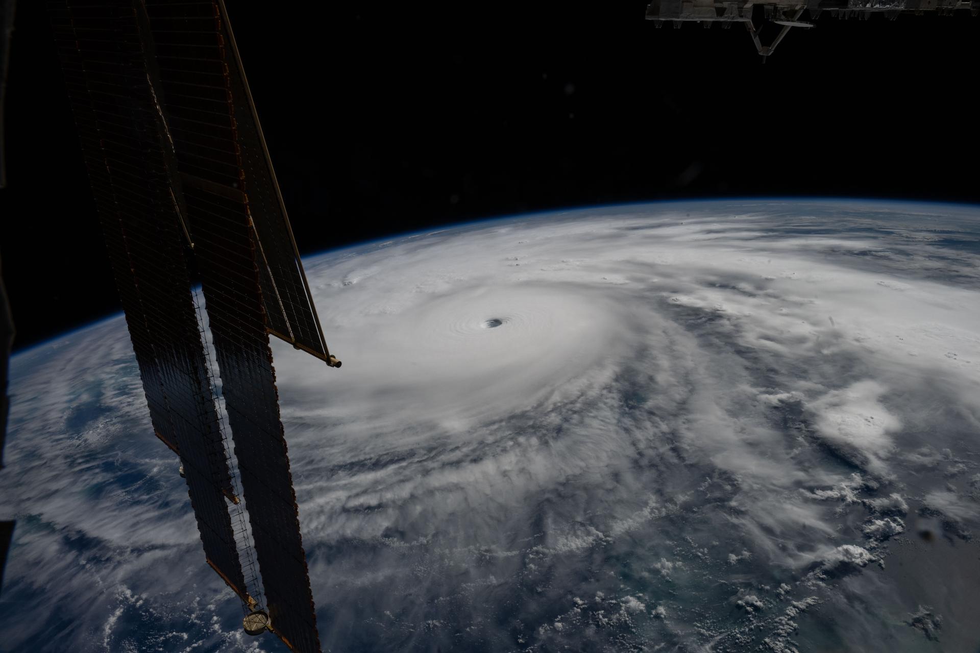
In October 2025, Hurricane Melissa was observed 50 miles off the coast of Jamaica, as captured by the International Space Station. NASA and its European partners launched the Sentinel-6B satellite in November 2023, aiming to enhance hurricane forecasts, safeguard infrastructure, and assist commercial industries like shipping. Currently, Sentinel-6B travels 30 seconds behind its predecessor, Sentinel-6 Michael Freilich.
Both satellites operate under the Copernicus Sentinel-6/Jason-CS mission, a series of ocean-observing radar altimetry missions continuously monitoring Earth's changing seas since the early 1990s. This data aids scientists in deciphering El Niño’s impact and refining hurricane predictions. Josh Willis, Sentinel-6B's project scientist at NASA's Jet Propulsion Laboratory, noted that this El Niño, although late to emerge, is expected to be severe, mirroring the intensity of significant El Niños in 1997 and 2015.
El Niños disrupt weather patterns, including hurricanes, by shifting ocean heat from the equatorial Pacific to the South American coast, thereby altering hurricane activity. Sentinel-6B began transmitting valuable data on July 15, 2025, which will eventually improve weather prediction models. This data contributes to hurricane tracking algorithms utilized by federal and state agencies, potentially triggering disaster response measures, evacuations, and resource allocation.
NOAA's Satellite Ocean Heat Content Suite, overseen by Deirdre Byrne, integrates Sentinel-6B's ocean height measurements to forecast hurricane intensification. Byrne emphasized the critical role of accurate ocean height data in predicting rapid hurricane intensification in the 48 hours before landfall.
Written by urgent.news from NASA's reporting — not their text. Machine-written — may contain errors; check the original before relying on it.
This story
This is one outlet's version. Read the fullest account.