Satellite imagery shows reservoir drought worsening across North Korea
I analyzed satellite imagery from the European Space Agency’s Sentinel satellites throughout August 2026. My goal was to assess the condition of major agricultural reservoirs across North and South Korea. The review found that a summer heat wave and abnormal weather patterns have driven a sharp, widespread reservoir drought. Optical images from the Sentinel-2 satellite […]
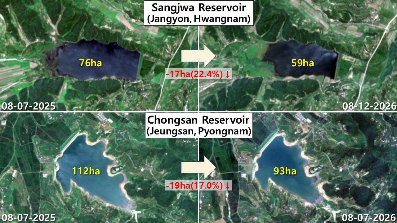
Satellite imaging has revealed a worsening drought across key reservoirs in both North Korea and South Korea as the region experiences extreme heat and abnormal weather patterns. In North Korea, the Sangjwa Reservoir lost 22.4% of its water surface area, reducing from 76 hectares to 59 hectares. The Chongsan Reservoir also experienced a 17% decline, shrinking from 112 hectares to 93 hectares.
The Muan Reservoir in South Hamgyong province saw a 21.9% reduction in size, from 32 hectares to 25 hectares. In South Korea, the situation is even more severe, with the Jangsong Lake experiencing a staggering 43.4% loss in surface area, dropping from 587 hectares to 332 hectares. This massive decline exposes large sections of lakebed, exacerbating the impact on South Korea's agricultural water supply during the critical ripening stage of rice crops.
The divergent weather patterns observed, including localized heavy rain, have resulted in contrasting outcomes for reservoirs in eastern North Korea. While some reservoirs, like the Bongnae Lake in Kangwon province, expanded by 16.6%, others, such as the Jangsong Lake, suffered a drastic 43.4% reduction in area.
Written by urgent.news from Daily NK's reporting — not their text. Machine-written — may contain errors; check the original before relying on it.