U.N. approves resolution in support of map that shows Africa’s true size
16th-century Mercator map diminishes size of Africa; Togo-led U.N. initiative to further African Union campaign for new map; West African nation aims to use Equal Earth map in schools by the end of the year; United States was the only country to vote against
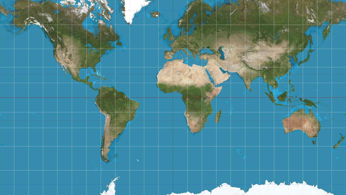
The United Nations approved a resolution on September 4, 2026, advocating for a shift away from the Mercator map towards a more accurate representation of countries' true size. Sponsored by African states, the resolution aims to counteract the perception that Africa is peripheral. Togo spearheaded the initiative, building on the African Union's campaign to limit the use of the Mercator map, which distorts the size of land masses by exaggerating those closer to the poles.
Greenland, for instance, appears nearly as large as Africa on a Mercator map, despite Africa being approximately 14 times larger. Togo's Foreign Minister, Robert Dussey, emphasized that "a fair world begins with a fair map." The resolution, passed by a vote of 164 to 1 with 6 abstentions, promotes the Equal Earth projection, which more accurately depicts the size of continents.
However, it remains non-binding and does not challenge the use of the Mercator projection for maritime and aerial navigation, where it is still applicable. The United States was the sole country to vote against the resolution, arguing it promoted an "ideological agenda" and detracted from "genuine problems of international peace, prosperity, or good relations."
Togo intends to replace its school geography materials with Equal Earth projection maps by the end of the year and plans to encourage others to adopt the new map, including governments, schools, international organizations, and technology companies. Dussey linked the campaign to broader African efforts to address colonial-era legacies, clarifying that the move was not an attack on Europe or any other civilization. The Mercator map's prevalence is largely due to colonialism, he noted.
Written by urgent.news from The Hindu - Sci-Tech's reporting — not their text. Machine-written — may contain errors; check the original before relying on it.