Unstable Tibetan Plateau risks cascading disasters as glacier losses mount in Nepal, China
Glaciers on the Tibetan Plateau are likely to become more unstable, which may lead to more collapses and collateral disasters, a senior climate official warns as the death toll from last week’s catastrophic landslide and flood on the China-Nepal border continues to rise. “Over the past 60 years, the glacier area on the Tibetan Plateau has shrunk by around 24 per cent, with around 7,000 small…
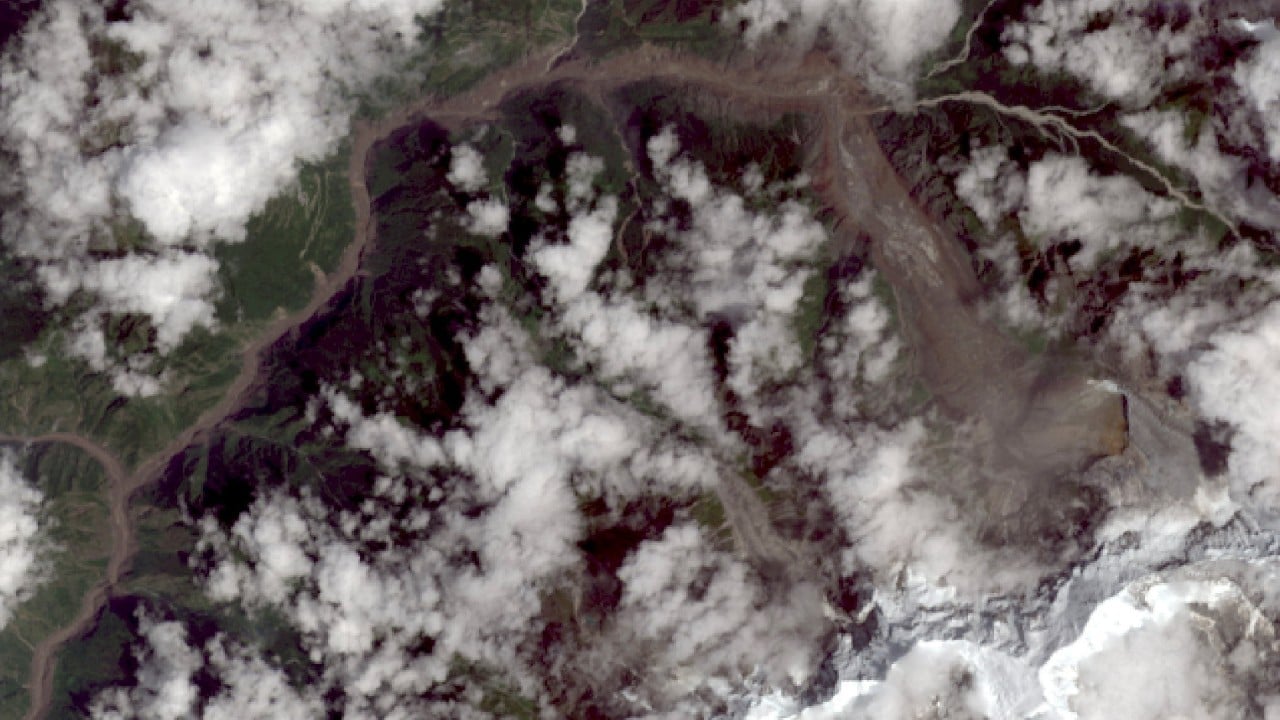
A senior climate official has warned that the glaciers on the Tibetan Plateau are becoming increasingly unstable, which could result in more collapses and secondary disasters. Over the past 60 years, the area covered by glaciers on the plateau has shrunk by 24%, with around 7,000 small glaciers vanishing entirely. Gao Rong, deputy director of China's National Climate Centre, stated that glacial disasters are likely to become more frequent and potentially more destructive, with consequences that could spread through cascading effects.
The recent catastrophic landslide and flood at the China-Nepal border has resulted in a rising death toll. China has reported 21 deaths and 541 people missing, while Nepal has seen the death toll rise to 1,114 as of Wednesday afternoon, with approximately 3,900 people still unaccounted for. China has increased cross-border support to Nepal, delivering emergency supplies and experts to assist in the rescue efforts.
The second batch of supplies arrived in Kathmandu on Tuesday, accompanied by DNA identification experts, and a third shipment along with a second expert team is being prepared.
Heavy machinery has reached the affected area on the Chinese side, aiding a deeper search. The landslide traveled 22km along the valley and reached the border crossing in just seven minutes. Scientists emphasize that hazard evaluations can no longer be based solely on the initial collapse. A study led by the Institute of Tibetan Plateau Research at the Chinese Academy of Sciences, in collaboration with several other institutions, revealed that downstream erosion plays a critical role in the scale of destruction.
The researchers analyzed satellite and field data from Gyirong County, finding that collapsing ice and rock swept down the 22km valley, eroding the riverbed, carrying debris, and mixing with water, turning a high-altitude collapse into a devastating mudslide. Consequently, the Chinese researchers contend that disaster risk assessment in high-mountain regions must consider factors beyond the initial failure volume of material breaking away from the mountain, such as valley bulking potential, which is the capacity of the landslide to increase in size as it travels downhill, and downstream exposure.
An article published in Nature emphasized the urgent need to enhance future monitoring and forecasting systems, noting that the disaster was difficult to predict due to the sudden failure of a high-altitude glacier-rock system, rather than typical signals like extreme rainfall or rising glacial lakes. Manoochehr Shirzaei, a geophysicist at Virginia Tech, stressed the need for a regional satellite-based system that routinely searches for accelerating glacier and rock-slope deformation and directly connects this information to downstream flood and avalanche modeling.
Written by urgent.news from Reuters Business via SCMP's reporting — not their text. Machine-written — may contain errors; check the original before relying on it.