Sri Aman records Sarawak’s worst air quality at 4pm as API hits 215
KUCHING (Aug 28): Sri Aman recorded Sarawak’s worst air quality today, with its Air Pollutant Index (API) reaching 215 at 4pm, placing the district in the very unhealthy category. The reading, recorded by the Air Pollutant Index of Malaysia (APIMS), was the highest among monitoring stations across the state, with Sri Aman the only area [...] The post Sri Aman records Sarawak’s worst air quality…
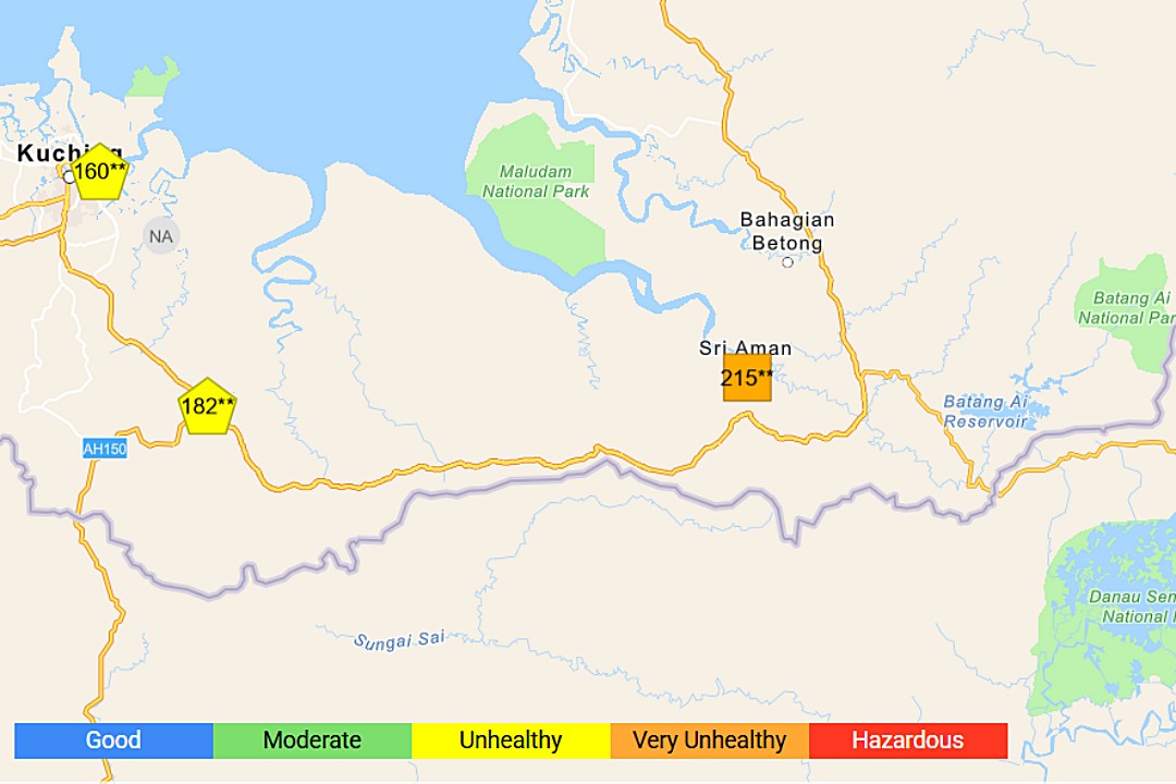
KUALA LUMPUR: Air quality in parts of Sarawak, particularly Sri Aman, has reached a "very unhealthy" level, with an Air Pollution Index (API) reading of 211 as of 2pm today. This is significantly worse than the "unhealthy" range that was recorded in 21 other areas nationwide. In contrast, 44 areas were reported to have moderate air quality, while just one area was in the "good" category.
The most polluted areas in Sarawak were Serian with an API of 182, Sarikei at 159, Kuching at 157, Bintulu at 120, Miri at 116, and Sibu at 101. In Peninsular Malaysia, cities such as Cheras, Kuala Lumpur (160), Seberang Perai and Minden in Penang (158), Taiping in Perak (155), Seberang Jaya in Penang (154), Sungai Petani in Kedah (154), Johan Setia in Shah Alam (Selangor), and Batu Muda in Kuala Lumpur (152 each) also experienced unhealthy air quality.
The deteriorated air quality was attributed to haze movement from various directions, as reported by the Asean Specialised Meteorological Centre (ASMC). Satellite images detected 514 hotspots in Kalimantan, 176 in Sumatera, and three in Malaysia - one each in Johor, Sarawak, and Terengganu. The ASMC's Regional Haze Map for today showed dry conditions across much of southern ASEAN, with moderate-to-dense haze observed in western Borneo.
Moderate-to-dense smoke plumes were particularly noted in several areas in Kalimantan and central and southern Sumatera, leading to air quality levels that ranged from unhealthy to hazardous in various monitoring stations.
In response, the Department of Environment (DOE) has intensified enforcement and daily patrols in areas prone to open burning. They have also activated the National Open Burning Action Plan and the National Haze Action Plan. The DOE advised landowners to monitor areas prone to fires, including landfills, forests, peatlands, plantations, agricultural areas, and industrial sites, and to take necessary measures to prevent encroachment that could lead to open burning.
Written by urgent.news from New Straits Times's reporting — not their text. Machine-written — may contain errors; check the original before relying on it.
This story
This is one outlet's version. Read the fullest account.