Yellow warnings in force as rain and thunderstorms hit parts of UK
Torrential downpours will affect parts of England and Wales, delivering some of the wettest weather in several weeks
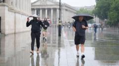
Yellow warnings are in effect as rain and thunderstorms sweep through parts of the UK on Wednesday. The Met Office has extended a thunderstorm warning, valid until 10 PM BST, to include northern and eastern Wales, north-west England, the Midlands, and parts of eastern and southern England. Heavy rain could lead to flash flooding and disrupt travel, with lightning and large hail posing additional dangers.
Another yellow warning is set for Thursday, with more thunderstorms expected across England and Wales. Some areas that have received minimal rain so far this August could experience their wettest weather in weeks. The Met Office warning covers a large portion of England and Wales. Early cloud and rain will give way to sunny spells, but scattered thundery downpours will occur in the afternoon. Up to 20-30mm (0.8-1.2in) of rain could fall in an hour, and 40-50mm (1.6-2in) may accumulate over a few hours in some locations.
Flash flooding is a significant concern, especially on hard ground following a prolonged dry spell. Driving conditions may become difficult, with some roads potentially closed. Large hail and frequent lightning are also possible. Northern Ireland will experience some showers, though they will likely be less intense and less thunderous. Most of Scotland will remain dry, with sunny intervals, though scattered showers may develop in the southwest later.
Thursday will bring additional thunderstorms, affecting primarily England and Wales. The Met Office has issued a new yellow warning, in force from 6 AM to 10 PM BST. Expect widespread rainfall totals of 20-30mm (0.8-1.2in) within three hours, with some areas possibly seeing 50mm (2in) in the same timeframe. In rare cases, eastern-facing hills exposed to easterly winds may record 75mm (3in) over 12 hours, raising the risk of significant flooding. Gusty winds may accompany the storms, particularly in southern England on Thursday morning.
The showers may reach southern Scotland and Northern Ireland, though they are expected to weaken and become less intense as they move north. While last week's unsettled weather has brought little rain to some southern parts of the UK, the upcoming rain will likely far exceed recent totals in these areas. Places like Brize Norton in Oxfordshire have only recorded 0.4mm of rain so far in August, less than 1% of their average monthly rainfall.
Kew Gardens in London has seen no rain at all this month, and July was even drier, with only 1.8mm of precipitation.
The rain is expected to outpace recent totals in some areas, leading to potential flooding downpours. However, other nearby locations may remain relatively dry, with weather apps often failing to accurately predict the heaviest rain. Forecasts can be challenging, as computer models struggle to pinpoint the exact locations and timings of the most severe storms.
Some storms may occur at night, remaining undetected on daily weather icons. Keep an eye on hourly weather symbols and the percentage chances of rain when planning outdoor activities.
Written by urgent.news from BBC News's reporting — not their text. Machine-written — may contain errors; check the original before relying on it.
This story
This is one outlet's version. Read the fullest account.