Oil pipeline damage to be tracked by heat-sensing satellites
Damage to oil and gas pipelines and other energy infrastructure can be tracked in near real-time from space , using new heat-sensing images. The heat from damaged or leaking pipelines is detected and captured with infrared thermal imagery at high resolution from low-earth orbit satellites. This could be a flare that would lead to a bright light, or a break in the pipeline, or puddles of oil from…
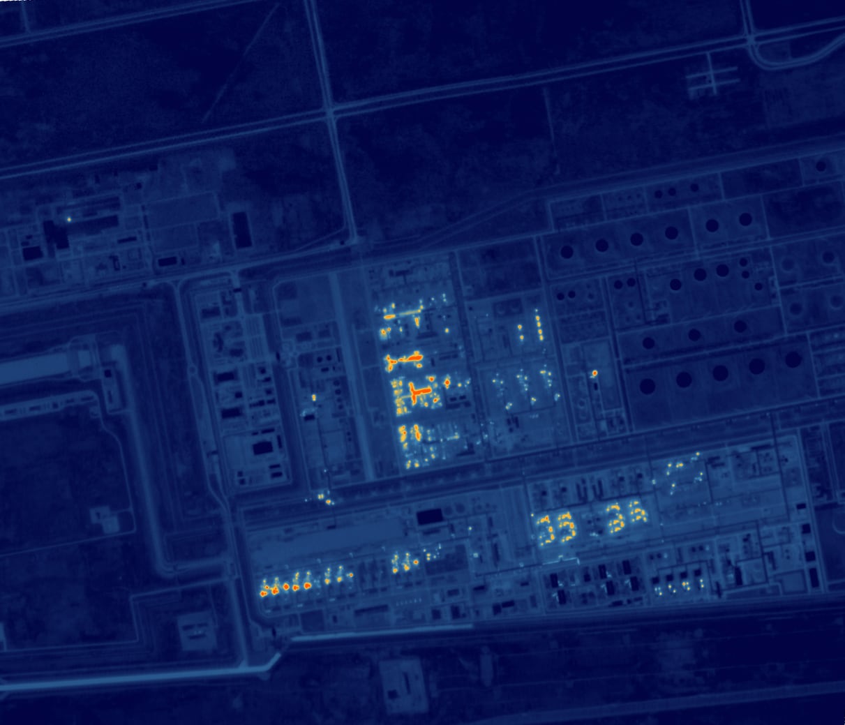
Oil and gas pipelines can be monitored in near real-time from space using heat-sensing infrared imagery. This heat is captured by high-resolution satellites orbiting at low-earth orbit. The imagery is now being distributed by Saudi Arabia's national Earth observation platform, Neo Space Group's UP-42, from the technology company SatVu.
Scott Herman, the chief technical officer for SatVu, explained that the heat signatures of damaged or leaking pipelines can be identified with high detail using this technology. These can range from a flare of bright light to leaks or puddles of oil. The infrared imagery can reveal differences in temperature along the pipeline that indicate potential issues. This level of detail extends to the ability to view inside pipes and buildings.
The pipeline expansion by Saudi Arabia's Aramco to bypass maritime blockades conducted by Yemen's Houthi rebels can be analyzed through these thermal images. Increased activity on the East-West pipeline and reduced oil tanker activity in the Gulf are visible through infrared images. Energy facilities in the Gulf have also been targets of Iran during the US-Iran war, leading to reduced operations or temporary shutdowns in response to attack risks.
The high-resolution thermal imagery provides a transparent insight into the activities of energy facilities, allowing energy traders to monitor production levels and facility operations. SatVu's infrared cameras are 30 times more powerful than NASA's Landsat and ESA's Copernicus programs, allowing them to detect heat emissions from small spaces like cars.
The US is believed to possess similar thermal imagery, but SatVu's commercially available images can be used for intelligence-sharing with Middle Eastern allies without disclosing sensitive information. Sample images include the Saudi Aramco refinery in Jazan and the Yasref refinery in Yanbu Industrial City, both of which have been targeted by the Iran-backed Houthis. The images are being resold through Neo Space Group and UP-42.
These thermal images can also be used to assess the environmental impact, particularly in urban or industrial settings. For instance, a thermal image of Riyadh at night shows how the road network absorbs and radiates heat, providing insights into city planning and energy efficiency.
Written by urgent.news from The National UAE's reporting — not their text. Machine-written — may contain errors; check the original before relying on it.
Also reported by 1 other outlet
- Oil pipeline damage to be tracked by heat-sensing satellites thenationalnews.com