NASA shows Crimea as Russian on a map during its eclipse broadcast
It's the latest in a run of Western maps quietly erasing the line international law still draws around occupied Crimea—this time from the US space agency.
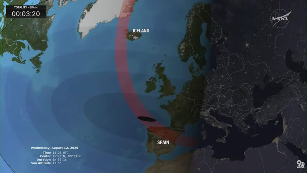
On August 12, 2026, NASA displayed a map during a live broadcast of a total solar eclipse that showed Crimea as part of Russia. This map separated the Crimean peninsula from mainland Ukraine with a border line, despite international law and the consensus of the world's states that Crimea remains Ukrainian territory. The annexation of Crimea by Russia took place in 2014, and both Ukraine and the majority of nations worldwide still consider the annexation illegal.
The error in NASA's map during the eclipse broadcast misrepresented the status of Crimea according to international law.
Written by urgent.news from Euromaidan Press's reporting — not their text. Machine-written — may contain errors; check the original before relying on it.