This interactive atlas captures more than a thousand literary journeys.
Have you ever wondered how long those nice people were actually stranded on the Orient Express? Or speculated about the carriage distance from London to Longbourn? Well, dear reader, have I got a tip for you. Reading Maps is home to
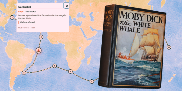
The interactive atlas "Reading Maps" offers curious readers the chance to explore famous literary journeys. Created by Aires Loutsaris, a UK-based SEO consultant who moonlights as a cartographer, the free atlas showcases over a thousand literary routes. Organized by mode (overland, sea) and type (survival, exile, coming of age), the atlas includes both intercontinental epics like Moby Dick and local adventures such as Mrs. Dalloway.
Inspired by the desire to go beyond the pages, Loutsaris and his developer Fabio Moreira embarked on building the atlas, which allows readers to submit their own novel or film-inspired routes. The map-making process involves examining the text's settings and coordinates, comparing them to real-world locations, and making editorial notes for any invented places.
Maps provide a sense of scale and help readers grasp distances, such as the length of the Mississippi River in Mark Twain's "Huckleberry Finn." They also offer insight into character motivations, like comparing Phileas Fogg's railway journey in Jules Verne's "Around the World in Eighty Days" to his sea voyage.
Loutsaris encourages readers to submit their requests, regardless of how strange or specific they may seem. The atlas currently has a strong canonic focus, with The Odyssey being the most requested journey. However, the site's open-door policy ensures that all literary journeys are welcome. The cartographer's favorite map comes from Bernard Moitessier's 1970s maritime adventure, "The Long Way," as it encapsulates the essence of the book.
Written by urgent.news from Literary Hub's reporting — not their text. Machine-written — may contain errors; check the original before relying on it.